

| Version 18 (modified by , 14 years ago) ( diff ) |
|---|
The information on this page could be extended.
Languages:
Preferences > Map Settings

Settings for the map projection and data interpretation
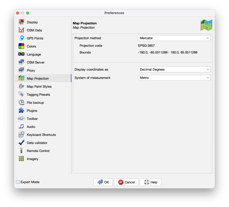
Map Projection
You can change the map projection method between Mercator, and some others. Be aware that projections maybe only valid for a certain area of the world.
The default projection for JOSM is Merkaartor. This projection has certain advantages, one of them is that geometric figures (e.g. circles and rectangles) aren't deformed when displayed.
When you use rasterized background imagery then you need to set a projection supported by the service providing this imagery. JOSM is not able to change raster images. When image projection and current settings do not match, you get warned.
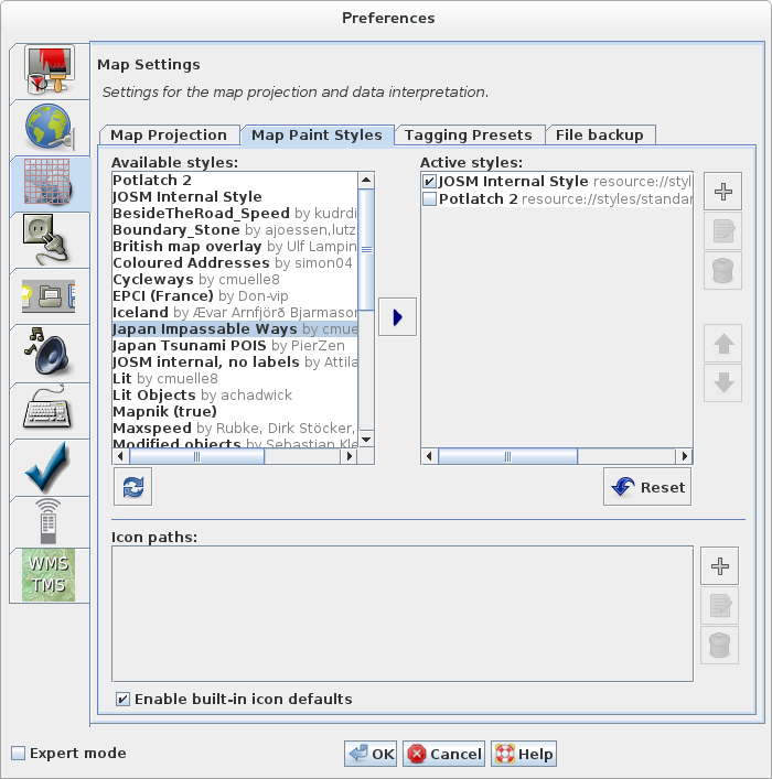
Map Paint Styles
In this section sources for displaying the data can be changed. Beside the internal styles also externals styles are presented and can be activated.
See Styles and Map Styles Toggle Dialog.
Tagging Presets
Presets allow you to select predefined tags for objects. From this area of the preferences menu you can choose which presets to use.
The preset list will be downloaded automatically and then add available presets using  , or include one from a URL or local file by clicking on
  .
.

Adding presets requires a restart of JOSM. Then the tagging presets can be selected from the main menu. They can also be added to the toolbar under Toolbar Customization.
See tagging presets for more details.
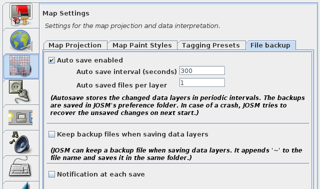
File Backup
If you save geo data to a local file and the file already exists JOSM writes the data to a temporary file (with the suffix ~). It then copies the temporary file to the target file.
In the File Backup settings you can specify whether JOSM should delete the temporary file or whether it should leave it as "backup" in the file system.
- Go to the tab File backup in the Map Preferences
- Select or deselect the checkbox Keep backup files
Back to Preferences
Back to Main Help
Attachments (3)
-
MapPaintStylesPreferences.png
(105.6 KB
) - added by 14 years ago.
screenshot
-
josm_prefs_file_backup.png
(62.9 KB
) - added by 6 years ago.
file backup screenshot
-
PreferencesMapProjection.png
(126.1 KB
) - added by 5 years ago.
new screenshot
Download all attachments as: .zip