

| Version 36 (modified by , 6 years ago) ( diff ) |
|---|
Languages:
Preferences > Imagery
 Adding or deleting predefined/custom WMS/TMS/WMTS imagery sources, general imagery settings, offset bookmarks and imagery cache settings.
To display an imagery ("background") in the Mapview use the Imagery menu instead.
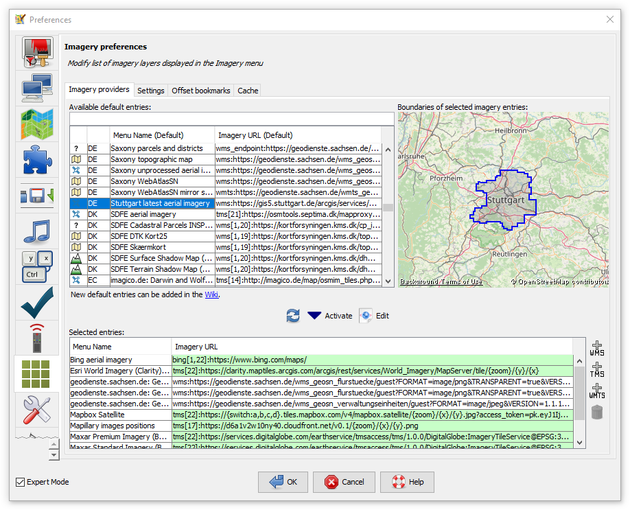
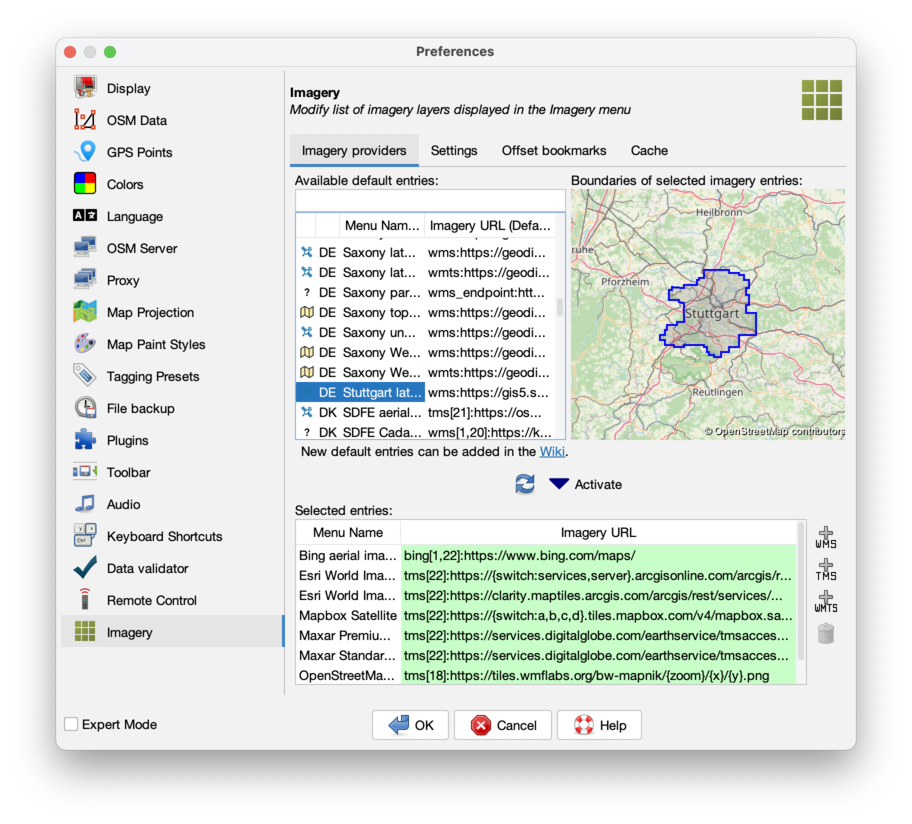
Imagery providers
Here you can modify the list of imageries which appear in the Imagery menu as well as edit entries.

The top left list contains all available sources. If you select a source and if it is not provided global its bounds are displayed on the little map on the top right. You can filter this list by typing in the box above. You can use parts of the source name, the country code (e.g. cz), the country name (e.g. czech republic, use the country name in the language JOSM is set to), the source category (photo, elevation, historicphoto, map, historicmap, osmbasedmap, quality assurance or other) or the URL.
The bottom list contains all entries which will appear in the Imagery menu. To copy an entry from the top list to the bottom list select it in the top list and click on the ![]() Activate button. Activated default entries are highlighted green in both lists. (The green color doesn't say anything about the state/health of the servers they mention, nor the validity of the URLs.)
Activate button. Activated default entries are highlighted green in both lists. (The green color doesn't say anything about the state/health of the servers they mention, nor the validity of the URLs.)
To update (reload from JOSM server) the list of default entries on the top click on the ![]() button.
button.
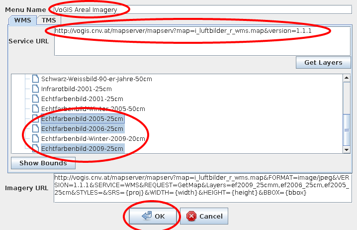
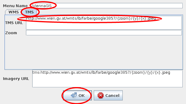
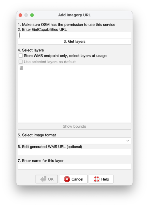
To add an custom WMS/TMS/WMTS source click on the respective button on the right: ![]() ,
, ![]() or
or ![]() and follow the instructions.
and follow the instructions.
To delete an entry in the bottom list select it and click on the ![]() button.
button.
To add an entry to the top list of default entries read the Documentation and edit Maps or its subpages (for advanced users).
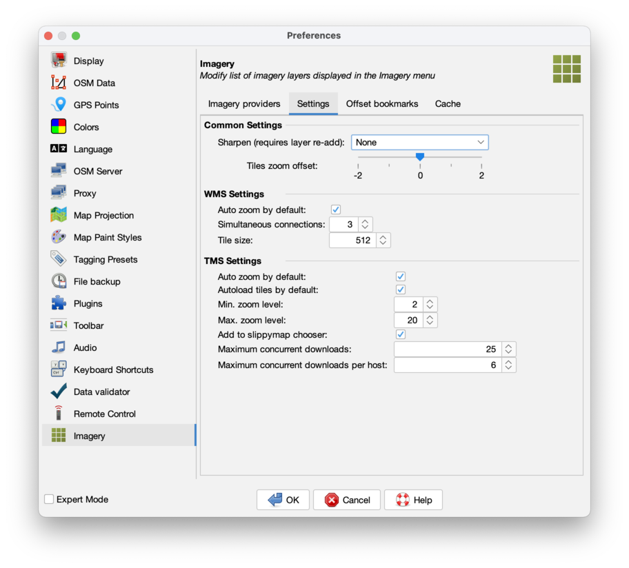
Settings
Here you can edit some general imagery settings.
Tiles zoom offset: offset between calculated zoom level and zoom level used to download and show tiles. Negative values (underzoom) will result in lower resolution of imagery useful in "retina" (high-dpi) displays, positive values (overzoom) will result in higher resolution, at the cost of increased memory consumption.
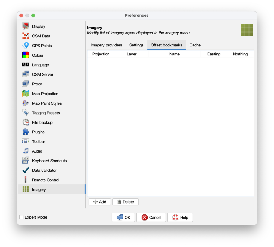
Offset bookmarks
Here are listed all offset bookmarks which can easily be added via "New offset" in the Imagery menu.
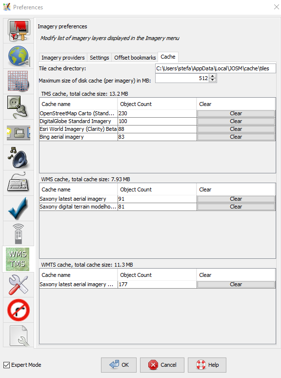
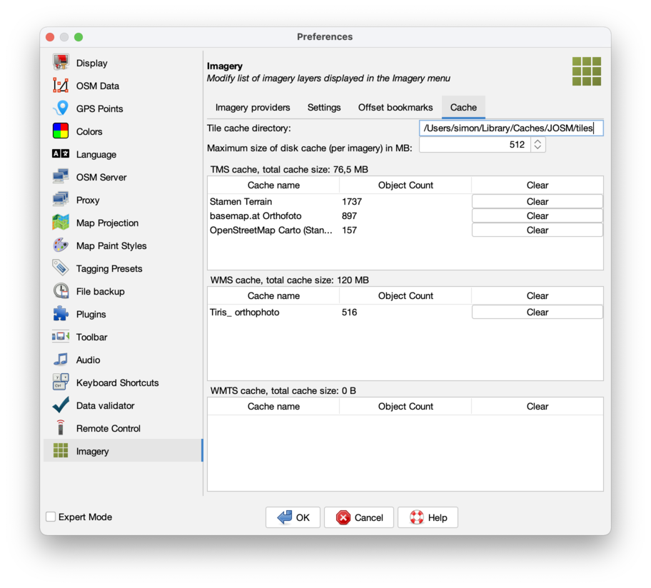
Cache
Here are listed all cached images (tiles) from each source. You can use the "clear" button in each line to delete the cached images for each source. You may need a JOSM restart to take effect in the Mapview.
A possibly existing "Mapnik" entry stems from using the slippy map shown by the JOSM download dialog in older JOSM versions. You can safely delete it.

Back to Main Help
Attachments (12)
- wms.png (25.2 KB ) - added by 14 years ago.
- wms-error.png (2.8 KB ) - added by 14 years ago.
- tms.png (11.7 KB ) - added by 14 years ago.
- scr_imagery_prefs_cache.png (71.4 KB ) - added by 7 years ago.
- predefined-imagery.png (193.8 KB ) - added by 6 years ago.
-
PreferencesImagerySettings.png
(151.1 KB
) - added by 5 years ago.
new screenshot
-
PreferencesImageryProviders.png
(434.6 KB
) - added by 5 years ago.
new screenshot
-
PreferencesImageryOffsetBookmarks.png
(121.9 KB
) - added by 5 years ago.
new screenshot
-
PreferencesImageryCache.png
(151.8 KB
) - added by 5 years ago.
new screenshot
-
PreferencesImageryAddWms.png
(69.5 KB
) - added by 5 years ago.
new screenshot
-
PreferencesImageryAddWmts.png
(58.5 KB
) - added by 5 years ago.
new screenshot
-
PreferencesImageryAddTms.png
(91.0 KB
) - added by 5 years ago.
new screenshot
Download all attachments as: .zip