

| Version 25 (modified by , 12 years ago) ( diff ) |
|---|
This page lacks of a lot of information. The bottom panel is missing completly, especially "Jump to Position" is missing.
Languages:
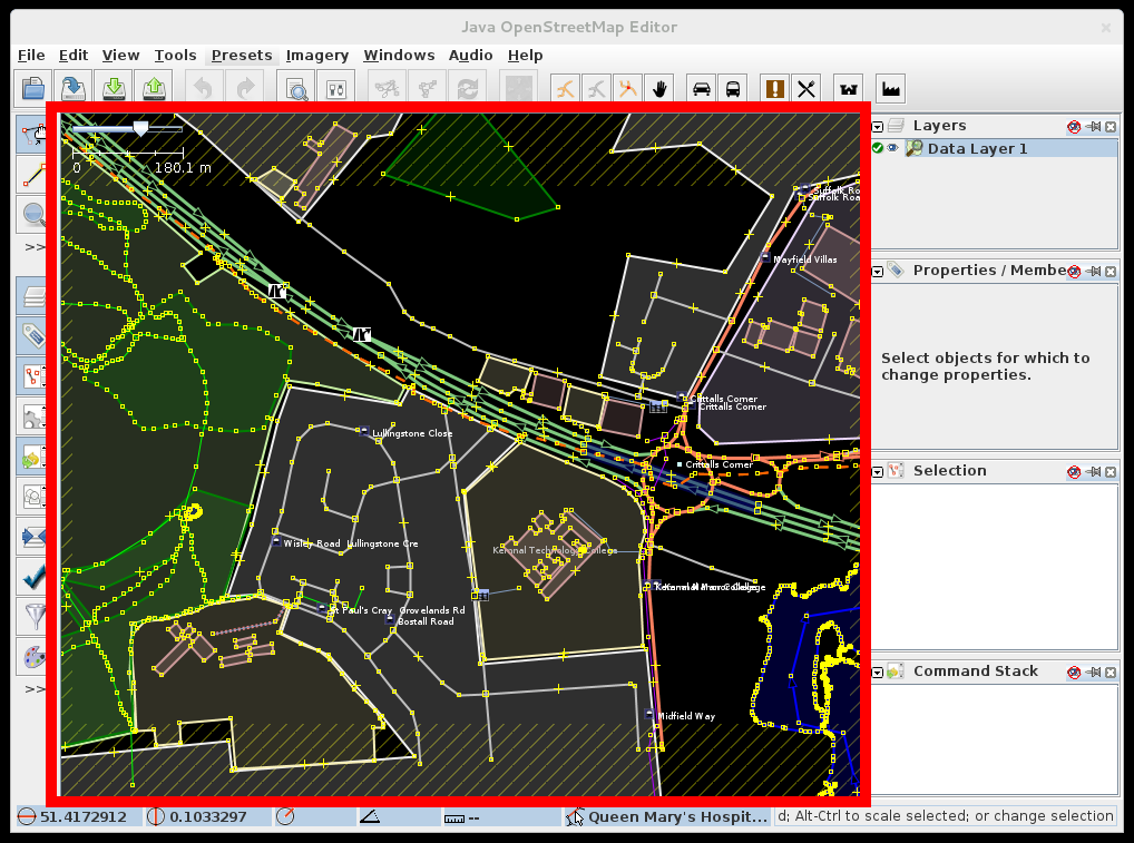
Map View
This is the main view in JOSM, where editing takes place, and Landsat and other images are displayed. There are different working modes which can change the interaction with the Map View.

Move map
The area displayed in the window can be moved by holding down the right mouse button, and dragging the mouse. (On a Mac with a one-button mouse, simulate right-click by holding down Ctrl while clicking the button.)
Zoom
You can zoom using the scroll wheel or the Plus- and Minus-keys. Alternatively there is an extra zoom mode and several other direct zoom actions in the view menu.
Middle Mouse Button
If you click the scroll wheel (middle mouse button) a popup menu will be shown that allows you to select objects that are on top of each other. Click the scroll wheel again to select the next entry in the list. Hold down the scroll wheel to auto cycle through the list. Hold down Ctrl to select objects in the list with the mouse. You can Alt+Left Click to cycle through these objects without having to use the popup. If the latter doesn't work on Ubuntu systems, it's likely the key combination is catched before it is passed to JOSM. To fix this issue, start the gconf-editor (it's a GUI app but not present in Ubuntu's default menus) and go to Apps → Metacity → General. Change the setting "mouse_button_modifier" to something else.
See also selecting single objects and select a way sharing common nodes
Left mouse button
Depending on the edit mode the left mouse button triggers different actions.
Staus bar
The status bar (bottom panel) displays the following information (from left to right):
| Field | Displays | Action when you click on it |
|---|---|---|
 | the geographic latitude of the mousepointer | opens the jump to position dialog |
 | the geographic longitude of the mousepointer | opens the jump to position dialog |
 | the (compass) heading of the line segment being drawn | none |
 | the angle between the previous and the current way segment. The background color of this field changes to green if [Action/AngleSnapping angle snapping] is active. | none |
 | in edit mode: the lenght of new way segment being drawn; in select mode: the lenght of selected way(s) or the distance of two selected nodes | changes the system of measurement (Metric → Chinese → Imperial → Nautical Mile). With a right click you can directly choose one measurement system |
 | the name, number of nodes and ID of the object at the mouse pointer | none |
| some helpful information about the current working mode | none With a right click you can copy to shown help text |
With a right click on the status bar you can choose if the statusbar gets hidden when hiding the dialogs panel (Tab).
See also
- Select Action - help on selecting, moving, and rotating objects in the map view
Back to Main Help
Attachments (3)
-
MapView.png
(249.1 KB
) - added by 13 years ago.
screenshot
- MapView2.png (191.6 KB ) - added by 12 years ago.
- labels_hiding.gif (4.2 MB ) - added by 8 years ago.