

| Version 3 (modified by , 7 years ago) ( diff ) |
|---|
Features
- Located in data menu
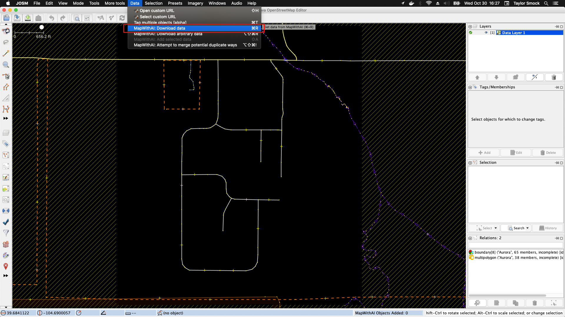
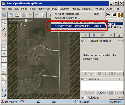
- MapWithAI: Download data: Download MapWithAI data from the current download area (if more than one layer, a dialog will ask for a layer to be selected). This is dependent upon configured URLs (defaults to MapWithAI).
- MapWithAI: Download arbitrary data (expert mode only): Download MapWithAI data inside an arbitrary bounding box, optionally cropping to the bounding box. The bounding box defaults to the current map view. This is also dependent upon configured URLs.
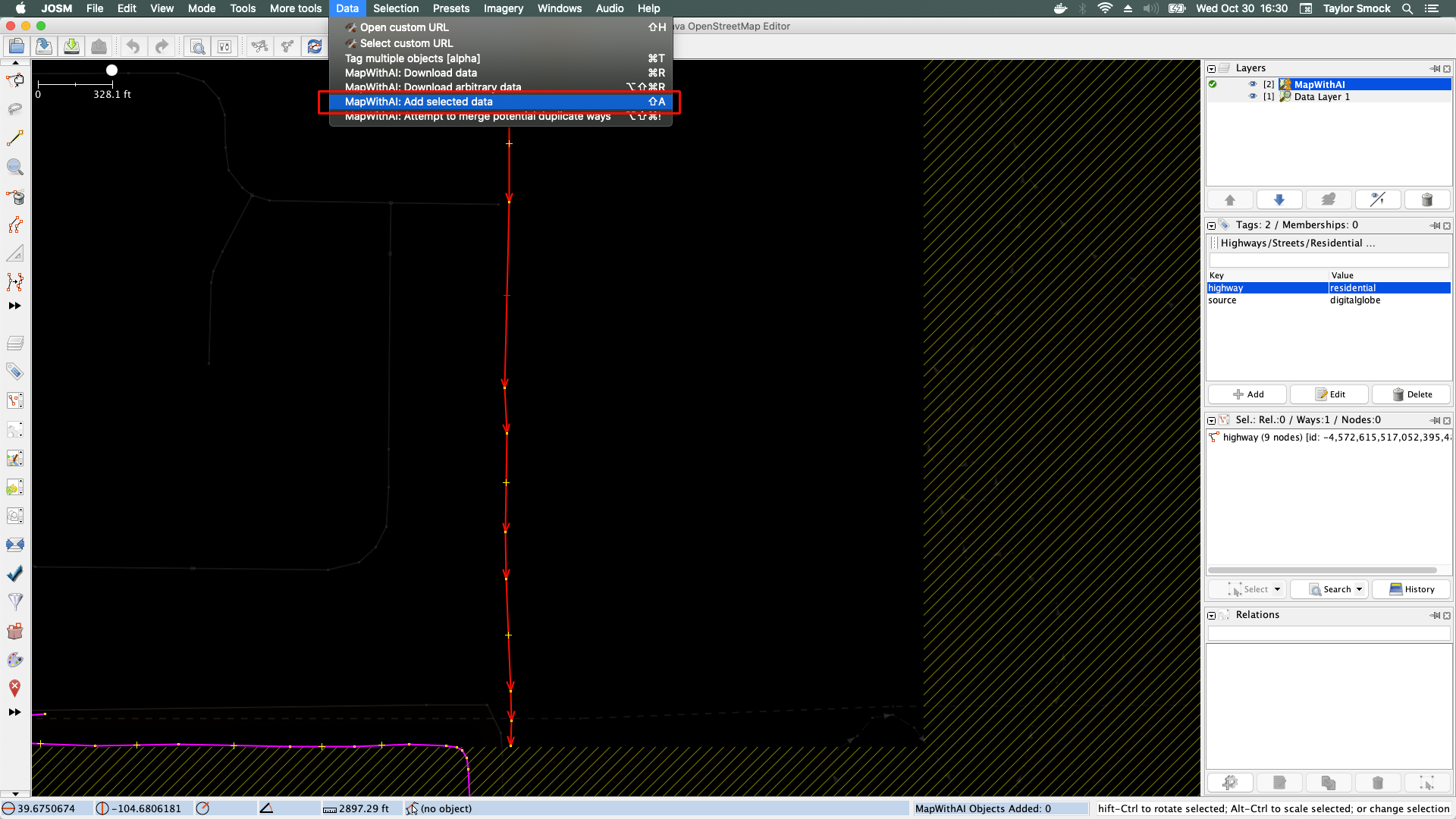
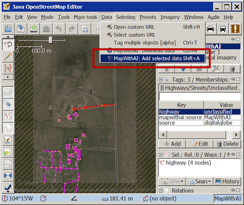
- MapWithAI: Add selected data: Add the selected data from the MapWithAI data layer to a OSM Data Layer
- MapWithAI: Attempt to merge potentially duplicate ways (expert mode only): Attempt to merge potentially duplicate ways. Done automatically for MapWithAI data, but is available for other uses (may or may not work as expected).
- Remote Control
- Upload Hooks
mapwithai: The count of OSM objects added and still present from the MapWithAI layer (splits and deletions may cause this to be inaccurate)mapwithai:options: A semi-colon (;) separated list of non-default optionsversion: The version of the MapWithAI plugin. Added in case there is a severe bug so it can be blacklisted.task: The bounding box for a task, if one is detectedmaxadd: The maximum number of MapWithAI objects that are permitted to be added per operation.<1allows any number of objects to be added.url: Shows non-default urls. Always the lastmapwithai:option.
- PaintStyle
- Automatically added by the plugin
- Can be automatically toggled on/off with the
MapWithAIlayer (this requires theMapWithAIplugin) - Can show
new,modified, orpre-existingMapWithAI data (depends upon thesourcetag).
- Live counter of objects added with
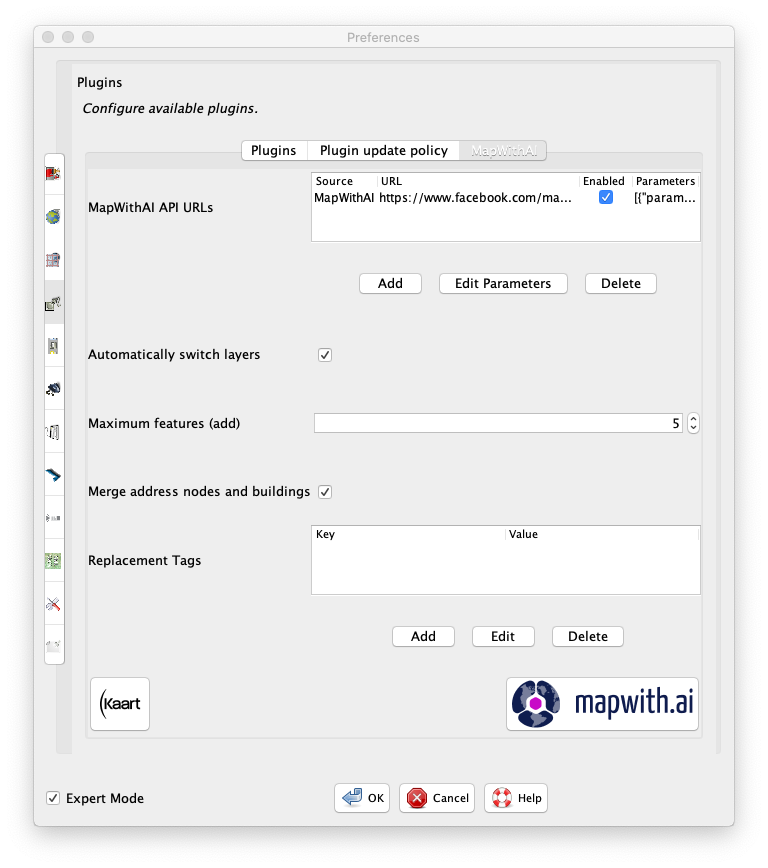
MapWithAI - Preferences
- Set MapWithAI url(s)
- Choose whether or not MapWithAI automatically switches layers
- Choose how many features you want to add per action
- Choose whether or not to merge buildings with address nodes (note: this only applies to buildings that will have one and only one address inside it)
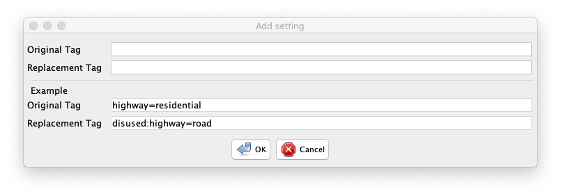
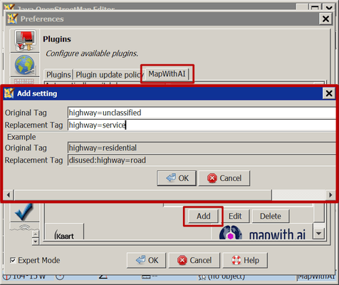
- Change tags (expert mode only) that you want to be replaced. For example,
highway=residentialcan becomedisused:highway=road.
Installation
Mandatory
- see Help/Preferences/Plugins for details)
Paintstyle (Plugin should automatically add and enable it)
- Start JOSM
- Open JOSM Preferences
- Go to
Map Settings(the globe with a grid over it) - Go to
Map Paint Styles - Add
MapWithAIfrom theAvailable stylelist - Press OK
Usage
Basic Usage
Please note that the screen shots were taken with Expert Mode checked in JOSM preferences. You may not see all the actions available without that check, the missing actions may be buggy or for a niche audience.
- Download an area of interest (either through a tasking manager or through the standard download window)
- Download data from MapWithAI by going to
Data->MapWithAI: Download Data(default keyboard shortcut isctrl+r/cmd+r, will conflict with aLiveGPSPluginshortcut).

- Switch to the
MapWithAIlayer if it is not already selected - Select an object or objects to add
- Add the object by going to
Data->MapWithAI: Add selected data(default keyboard shortcut isshift+a)

Advanced Usage
Preferences
MapWithAI Preferences are currently under JOSM Preferences -> Plugins -> MapWithAI.
| Preference | Explanation | Expert Mode |
|---|---|---|
| API URLs | URLs for MapWithAI service (if blank, resets to default after JOSM restart) | no |
| Automatically switch layers | if checked, when adding data switch layers automatically (default yes) | no |
| Maximum features (add) | The maximum number of features that can be added from the MapWithAI Layer in one action (default 5) | no |
| Merge address nodes and buildings | Merges buildings added from the MapWithAI layer with building nodes (default yes) | no |
| Table of replacement tags | Table of keys to replace (default is empty) | yes |
The table of replacement tags tags key and value entries in the format of key=TAG=VALUE and value=TAG=VALUE, for example:


Remote control
For current features, if JOSM is running with remote control enabled and the MapWithAI plugin is installed, you can go to http://localhost:8111/features?q=mapwithai .
Remote control only affects the current MapWithAI layer.
- Downloading data for current layers http://localhost:8111/mapwithai
- Setting a bbox to download data http://localhost:8111/mapwithai?bbox=longitude1,latitude1,longitude2,latitude2
- Setting an arbitrary URL http://localhost:8111/mapwithai?url=STRING
- Setting max objects to add in each action http://localhost:8111/mapwithai?max_obj=INT
- Setting autoswitch layer http://localhost:8111/switch_layer=BOOLEAN
- Setting a crop bbox http://localhost:8111/crop_bbox=longitude1,latitude1,longitude2,latitude2
Building
Attachments (9)
- SaveData.png (385.2 KB ) - added by 7 years ago.
- GetData.png (377.0 KB ) - added by 7 years ago.
- Installation.png (158.5 KB ) - added by 7 years ago.
- Preferences.png (187.2 KB ) - added by 7 years ago.
- TagReplacement.png (42.1 KB ) - added by 7 years ago.
- MapWithAIPreferencePanel.png (126.7 KB ) - added by 7 years ago.
- TagReplacement476.png (30.3 KB ) - added by 6 years ago.
- SaveData476.png (84.6 KB ) - added by 6 years ago.
- GetData476.png (81.4 KB ) - added by 6 years ago.
Download all attachments as: .zip
Note:
See TracWiki
for help on using the wiki.