

| Version 3 (modified by , 15 years ago) ( diff ) |
|---|
Languages:
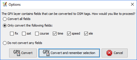
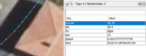
Layer > Convert To Data Layer

Creates a new OSM Data Layer comprising a Way for each track in the GPX data, consisting of a node in sequence for each track point.
This is very much only a starting point. You will need to spolit the Way up, connect them with correct topology, move nodes around, thin them out, tag them and so on. Never upload newly converted Ways!
Back to GPX Layer
Back to Toggle Dialogs
Back to Main Help
Attachments (2)
-
gpx_convert.png
(11.5 KB
) - added by 8 years ago.
from #16572
-
gpx_track_point.PNG
(24.3 KB
) - added by 8 years ago.
from #14103 by StephaneP, cutted
Download all attachments as: .zip
Note:
See TracWiki
for help on using the wiki.