

| Version 9 (modified by , 15 years ago) ( diff ) |
|---|
Altres idiomas:
Introducción a JOSM
Terminología
Un "nodo" es un punto y una "vía" es una línea que une múltiples nodos. Esto significa que "vía" es un término general para una serie de nodos unidos, no solo para carreteras o vías en realidad. Una "relación" es una secuencia ordenada de vías y nodos, un contenedor lógico para un grupo de elementos. Un "área" es una vía cuyos extremos están conectados, pero aparte de eso no es especial.
Si una carretera o pista o camino es curva, esto se aproxima usando un número de nodos en una vía,y pequeñas lineas que los conectan. Una vía tiene una dirección, que es útil para una serie de etiquetas, por ejemplo "oneway=yes" es una carretera que va solo en la dirección que la vía es dibujada. Otras etiquetas se refieren a estar a la izquierda y la derecha; de la dirección del recorrido a lo largo de la vía.
Iniciando JOSM
JOSM es un programa escrito en Java, y viene en archivo .jar . Si no sabes como iniciar, preguntale a alguien familiarizado con tu plataforma como ejecutar un programa Java. También puede leer las notas de instalación.
Cuando JOSM se inicia, se presenta con algunos mensajes sobre los cambio recientes en JOSM. Debería echar un vistazo a esta página de vez en cuando, ya que te mantiene informado sobre algunos de los cambios más interesantes.
Su siguiente paso debería ser para descargar algunos datos. Si usted tiene un archivo GPX (descargado desde su receptor GPS) para el área de interés, cargarlo en JOSM (Archivo/Abrir). Esto le mostrará el área del archivo GPX. Haga clic en la fecha verde apuntando hacia abajo  para ir a buscar los datos de openstreetmap.org.
Una alternativa es descargar los puntos GPX ya existentes desde el servidor de OSM. Para iniciar este proceso usted tendrá que saber la latitud y longitud del área correspondiente. La forma mas sencilla de hacer esto es usar el dialogo de descarga y mapa desplazable en la primera pestaña. Usted puede ver este mapa, ampliar y reducir y marcar el área que usted está interesado adentro. Lea más sobre el diálogo de descarga..
Editando en JOSM
JOSM es un editor fuera de linea que significa que todo no será visible para nadie mas hasta que sea subido al servidor. Esto hace que sea posible experimentar y varias veces mover, etiquetar, añadir y eliminar elementos sin romper nada. Subsequencia de acciones en un solo elemento va a entrar en la base de datos como una sola modificación cuando subido.
The first step of actual editing is to add a node to the OSM data where there will be a junction or a significant change in direction. To add a node, highlight the node button, either by clicking the 2nd button in the left menu bar, or by hitting the "A" key on the keyboard (the 2nd button should then be highlighted). Move the mouse cursor over your GPS track, and left click it wherever you want a node to be. A white dot (a selected node) should appear and a rubberline span from that dot to the mouse cursor. As you create subsequent nodes the earlier nodes will be shown as yellow dots.
A series of joined nodes forms a way.
Ways on their own are not of much use unless they are tagged to say what they represent. Map Features shows all the current key value pairs which could be used on a way. Ensure the properties pane is open on the right hand side of JOSM, the 8th button on the left (an icon with a wrench over a document) should be highlighted. If not click that button or hit "Alt+Shift+P". The properties pane has three buttons: a plus sign with "Add" next to it, then "Edit", then "Delete".
Editing properties refers to all the currently selected, i.e. highlighted, elements (nodes and ways). To select anything you must be in select mode which can be switched into by clicking the first of the left hand icons or hitting the "S" key. Ensure your new way is highlighted, then click the "Add" button, a dialog box will appear and you will be asked to select a key and a value. Type in the key/value pair which represents the way you are creating, e.g. for the key type "highway" without the quotes, and for value type "secondary" again without the quotes. Now click OK. You have now tagged your way.
Uploading to OSM
If you are happy with all that you have done then you need to upload this to OSM server. Click on the green up arrow  .
.
JOSM will give you an overview on the elements it's about to upload. You're also asked to provide a short freetext summary of your edits. This description will be saved with your data on the server and serves information purposes like for example the Recent Changes list.
With a click on "Upload changes" your data will be uploaded and visible for everyone else.
See Upload to OSM for further informations on uploading.
Convenciones
Un par de puntos adicionales acerca de la creación de vías.
1) Dual carriage ways should be drawn as two separate parallel ways, with each carriage way being a different way.
2) Si una calle es una vía (including the individual carriageways of a dual carriageway) the way should be drawn in the direction of travel.
3) Las etiquetas clave / valor son sensibles entre mayúsculas y minúsculas, todas las claves deben de ser ingresadas en minúsculas.
Volver a Ayuda principal
Attachments (4)
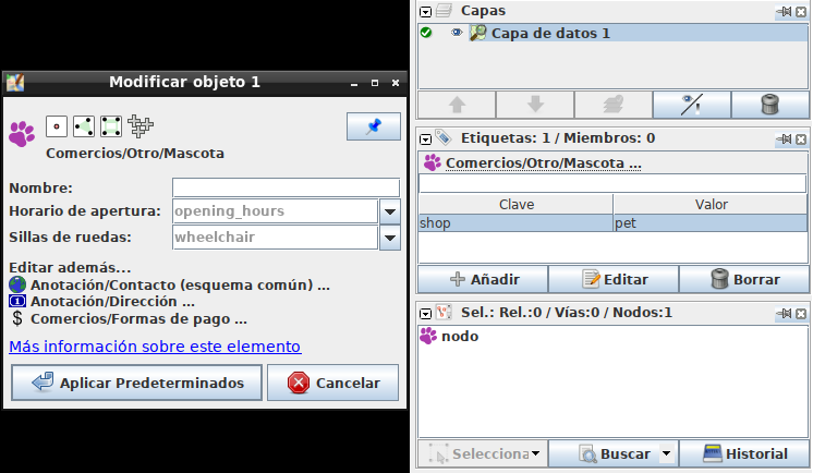
- single-preset-shown-in-context-of-tagsmemberships-single-object.png (55.4 KB ) - added by 8 years ago.
- presets-in-tag-toggle.png (11.2 KB ) - added by 8 years ago.
- presets-from-main-menu.png (72.0 KB ) - added by 8 years ago.
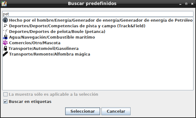
- presets-f3-search.png (33.9 KB ) - added by 8 years ago.
Download all attachments as: .zip