

Modify ↓
Opened 8 years ago
Closed 4 years ago
#16056 closed enhancement (duplicate)
GUI should show the Source Layer of the Geoimage window
| Reported by: | Hb--- | Owned by: | team |
|---|---|---|---|
| Priority: | normal | Milestone: | |
| Component: | Core image mapping | Version: | |
| Keywords: | ImageViewer geoimage | Cc: |
Description
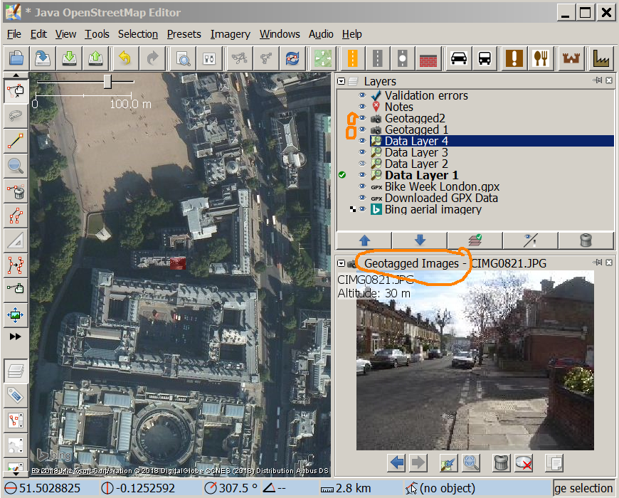
The Geoimage window shows photos from one Geotagged Images layer, called the source layer henceforth.
But the GUI indicates nowhere, which this source layer currently is.
Clicking an image on another Geotagged Images layer makes that layer the new source layer. So the Previous and Next buttons in the Viewer will surprisingly lead to other images just before. Navigating images over more than one image layers is unpredictable for the user. If the source layer is by chance the active layer, then the viewer does not show an image which is on another image layer. Feels like a bug, but it is part of the wanted behaviour.
Two suggestions:
- Show the actual name of the geotagged images layer in the title of the viewer instead of the fixed Geotagged Images.
- Place a symbol in the layer list to indicate the source layer. The second column is free for this. It has only the "native resolution of background imagery"-icon. A small camera icon would fit.

Attachments (1)
Change History (3)
by , 8 years ago
| Attachment: | imageviewertitel.png added |
|---|
comment:1 by , 4 years ago
comment:2 by , 4 years ago
| Resolution: | → duplicate |
|---|---|
| Status: | new → closed |
Closed as duplicate of #21605.
Note:
See TracTickets
for help on using tickets.
Replying to Hb---:
With r18591 we now have tabs per layer with the layer name, see #21605.
+1, still a possible enhancement