

Modify ↓
Opened 11 years ago
Last modified 4 years ago
#12124 new enhancement
area icons
| Reported by: | bastiK | Owned by: | team |
|---|---|---|---|
| Priority: | normal | Milestone: | |
| Component: | Internal mappaint style | Version: | |
| Keywords: | area icon style image-pattern | Cc: | Klumbumbus, gaben |
Description
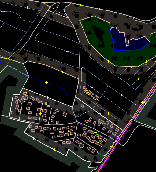
I find it hard to identify area features just from the color of the fill. landuse=forest, leisure=pitch and landuse=farmland, all look the same to me on the map. It would be nice to have patterns or other visual cues to tell them apart.
My idea is to use a papercutting style with silhouette icons. Here is how it could look:

You can see landuse=allotments, natural=wood and landuse=residential.
I've attached the style for testing.
Attachments (2)
Change History (4)
by , 11 years ago
| Attachment: | area-symbols-mockup.png added |
|---|
by , 11 years ago
| Attachment: | area-symbol.zip added |
|---|
comment:1 by , 11 years ago
| Cc: | added |
|---|
comment:2 by , 4 years ago
| Cc: | added |
|---|
Could be useful for editing without an imagery layer (as seen in the ticket).
Note:
See TracTickets
for help on using tickets.
test style