

 LastUpdated
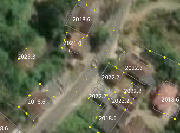
Display the last update time of each OSM way shown on screen. Useful for checking whether a particular mapping area has been updated recently or not.
")
meta
{
  title:"LastUpdated";
  version:"1.10_2026-02-26";
  description:"Display the last update time of each OSM way shown on screen. Useful for checking whether a particular mapping area has been updated recently or not.";
  icon:"lastupdated.png";
  author:"rphyrin";
}

area {
  text: auto;
  text: eval(concat(concat("20",substring(divided_by(osm_timestamp()-946692127,31556952),0,2)),"-",substring((divided_by(mod(osm_timestamp()-946692127,31556952),31556952)*12)+1,0,2)));
  text-halo-color: white;
  font-size:20px;
  text-anchor-horizontal:center;
  text-anchor-vertical:center;
  text-position:center;
}

way[highway]{
  text: auto;
  text: eval(concat(concat("20",substring(divided_by(osm_timestamp()-946692127,31556952),0,2)),"-",substring((divided_by(mod(osm_timestamp()-946692127,31556952),31556952)*12)+1,0,2)));
  text-halo-color: white;
  font-size:20px;
  text-position:line;
}
Last modified
5 months ago
Last modified on 2026-02-26T21:59:45+01:00
Attachments (2)
-
lastupdated-sc.png
(117.6 KB
) - added by 14 months ago.
(NOZIP)
-
lastupdated.png
(1.1 KB
) - added by 14 months ago.
Icon
Download all attachments as: .zip
Note:
See TracWiki
for help on using the wiki.