

Description of setttings is missing.
Languages:
Table of Content
Preferences > GPS Points
![]()
Settings controlling the drawing of GPS tracks. These settings control the display of track points if you use JOSM with GPS traces loaded in from a local file, or everybody's trackpoints downloaded from the OpenStreetMap server.
You can cause lines to be drawn between raw GPS points.
The size which GPS points are displayed in can be changed from standard to large.
Some settings are only displayed in expert mode.


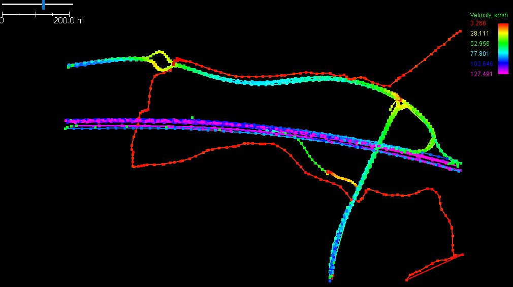
Track and Point Coloring
There are different ways to colorize gps-tracks.
When choosing one of Velocity, Direction or Dilution of Position, a legend is displayed in the top right corner of the map view if the gpx-layer is the current active layer. Example:
Additional Tabs
Additional tabs may be added by Plugins.
Back to Preferences
Back to Edit Menu
Back to Main Menu
Back to Main Help
Attachments (2)
-
PreferencesGpsPoints.png
(142.8 KB
) - added by 5 years ago.
screenshot
-
PreferencesGpsPointsExpert.png
(177.8 KB
) - added by 5 years ago.
expert mode screenshot
Download all attachments as: .zip