

#14343 closed enhancement (fixed)
[Patch] GPS heat map should also support point clouds
| Reported by: | kidelo | Owned by: | team |
|---|---|---|---|
| Priority: | normal | Milestone: | 17.02 |
| Component: | Core | Version: | |
| Keywords: | gps track, rendering, colormap, visualization | Cc: | Don-vip, michael2402, kidelo, Klumbumbus |
Description (last modified by )
Disadvantage:
With current implementation of GPS heatmap mode the lines of tracks are highlighted only.
Sometimes it would be better to see the distribution of points instead of lines.
see ticket:13124
Attachments (13)
Change History (25)
by , 9 years ago
| Attachment: | josm_ticket_1434_gps_heat_map _point_cloud_v1_by_kidelo.patch added |
|---|
comment:1 by , 9 years ago
| Description: | modified (diff) |
|---|---|
| Owner: | changed from to |
| Status: | new → needinfo |
by , 9 years ago
| Attachment: | heatmap_color_user_light.png added |
|---|
by , 9 years ago
| Attachment: | heatmap_color_user_normal.png added |
|---|
by , 9 years ago
| Attachment: | heatmap_config_new.png added |
|---|
by , 9 years ago
| Attachment: | heatmap_color_traffic_lights.png added |
|---|
by , 9 years ago
| Attachment: | heatm_draw_lines.png added |
|---|
by , 9 years ago
| Attachment: | heatm_draw_points.png added |
|---|
by , 9 years ago
| Attachment: | heatm_example_traffic_lights_draw_points.png added |
|---|
by , 9 years ago
| Attachment: | heatm_example_traffic_lights_normal.png added |
|---|
by , 9 years ago
| Attachment: | heatm_example_traffic_lights_limit_level.png added |
|---|
by , 9 years ago
| Attachment: | heatm_example_inferno_normal.png added |
|---|
by , 9 years ago
| Attachment: | heatm_example_inferno_increase_gain.png added |
|---|
by , 9 years ago
| Attachment: | heatm_example_inferno_decrease_gain.png added |
|---|
comment:3 by , 9 years ago
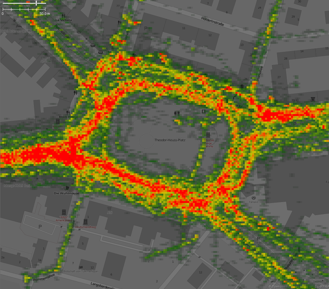
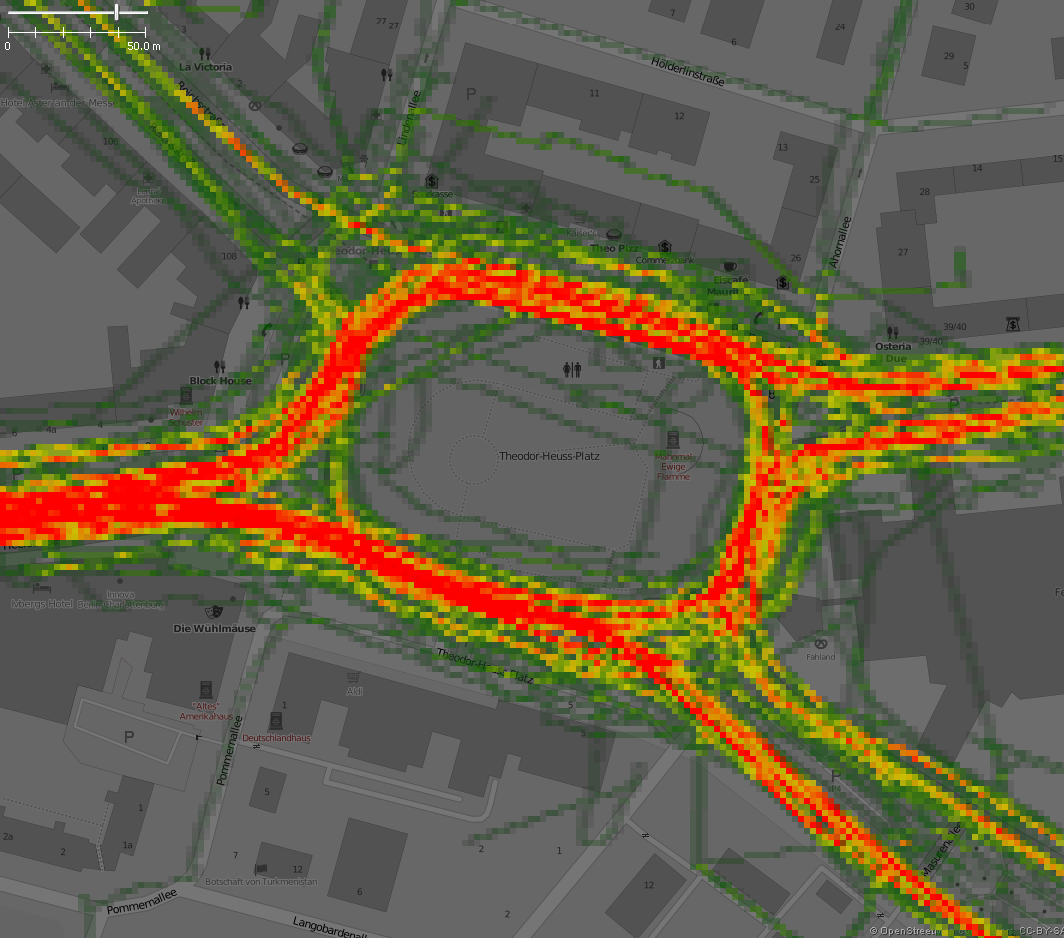
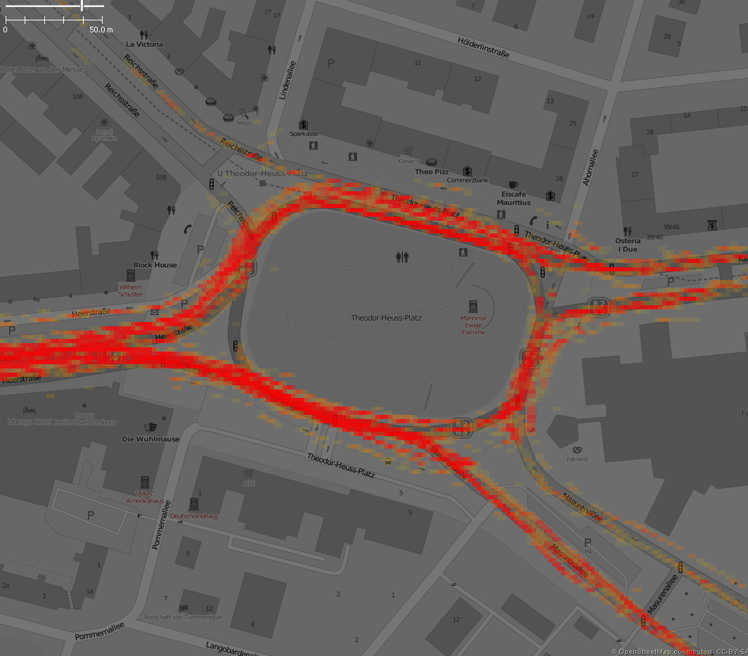
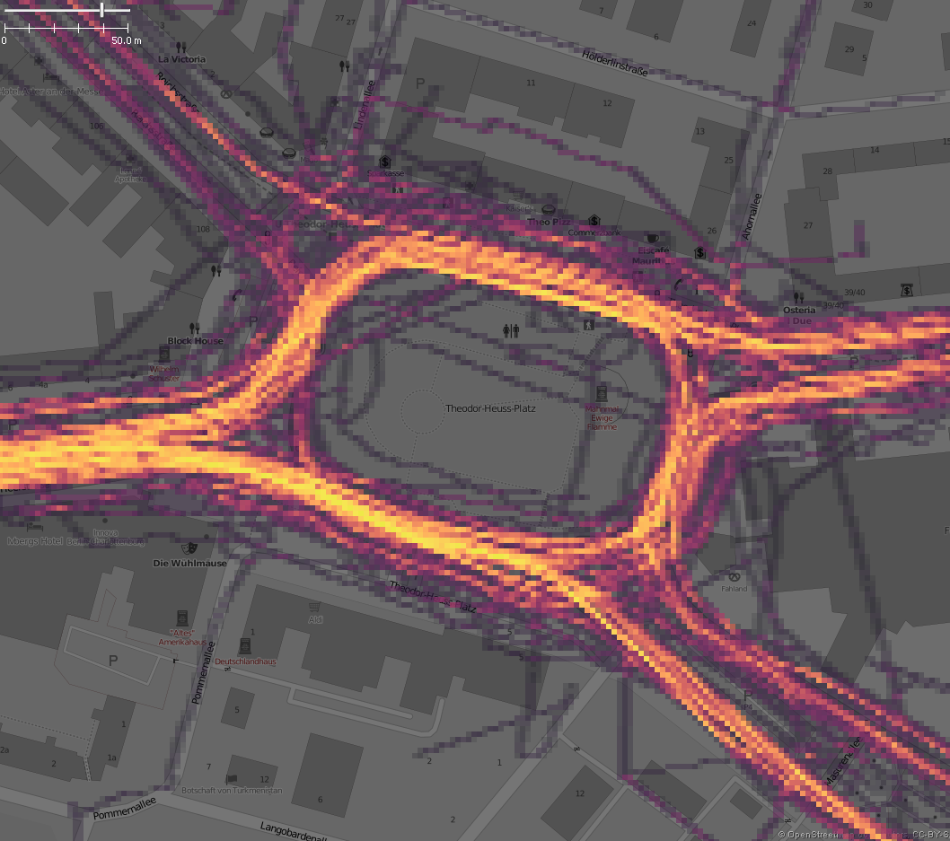
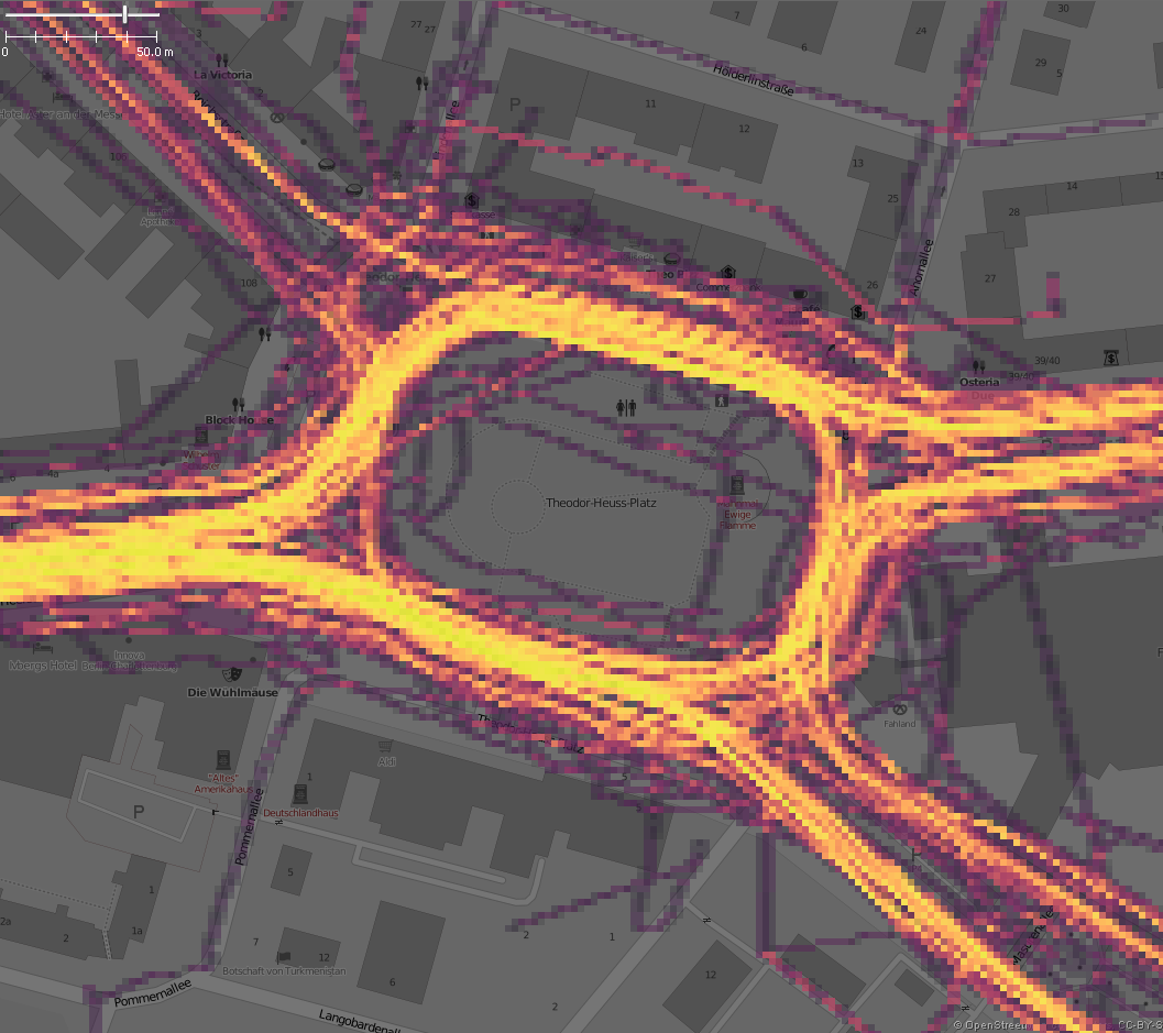
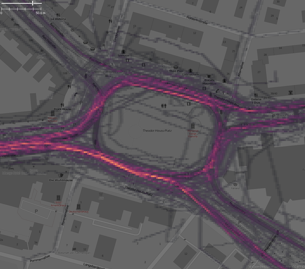
Some Examples
1. Normal Line Draw mode vs. Point cloud mode - Large Area


2. Normal Line Draw mode vs. Point cloud mode - Small Area


3. Decreased- /Normal- / Increased Gain


4. All Values (draw >0) vs. Limit Level (here draw > 150)

comment:4 by , 9 years ago
| Cc: | added |
|---|
comment:5 by , 9 years ago
| Summary: | GPS heat map should also support point clouds → [Patch] GPS heat map should also support point clouds |
|---|
comment:6 by , 9 years ago
| Owner: | changed from to |
|---|---|
| Status: | needinfo → new |
follow-up: 10 comment:9 by , 9 years ago
Why is the parameter abstractProperty not used?
    /**
     * Constructs a new {@code GpxDrawHelper}.
     * @param gpxData GPX data
     * @param abstractProperty The color to draw with
     * @since 10824
     */
    public GpxDrawHelper(GpxData gpxData, AbstractProperty<Color> abstractProperty) {
        data = gpxData;
        setupColors();
    }
comment:10 by , 9 years ago
Replying to Don-vip:
Why is the parameter abstractProperty not used?
    /**
     * Constructs a new {@code GpxDrawHelper}.
     * @param gpxData GPX data
     * @param abstractProperty The color to draw with
     * @since 10824
     */
    public GpxDrawHelper(GpxData gpxData, AbstractProperty<Color> abstractProperty) {
        data = gpxData;
        setupColors();
    }
The ctor parameter was introduced in 10824/josm, see #13309 (ticket). I am not sure why the parameter was not used. Looks like original idea was to bring the caching behavior to the GPXLayer. But the GpxLayer forward the paint() requests to GpxDrawHelper where a internal caching mechanism ( based on color, GPX style, current view area ) is used.
… import org.openstreetmap.josm.gui.dialogs.LayerListDialog;
…       …       public class GpxLayer extends Layer {
96      96          }
97      97
98      98          @Override
99                  public Color getColor(boolean ignoreCustom) {
100                     return drawHelper.getColor(getName(), ignoreCustom);
        99          protected ColorProperty getBaseColorProperty() {
        100             return GpxDrawHelper.DEFAULT_COLOR;
101     101         }
We should remove this parameter here and all is fine.
Some news: Here an update for GPS heatmap with enhancements which I had in mind. Please check and give feedback.
NEW: Heat Map mode now supports two difference modes
NEW: Overlay Gain Adjustment
NEW: Limitation of Visibility
IMPROVED: 2x new color maps