

Modify ↓
Opened 5 years ago
Closed 5 years ago
#21805 closed defect (invalid)
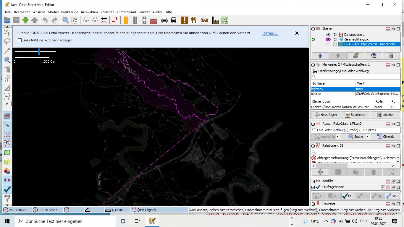
Some tools like 'lasso' and 'create Points' are not available (greyed ), if 1 additional GPS-Track is loaded, Data OSM not visible
| Reported by: | Owned by: | team | |
|---|---|---|---|
| Priority: | normal | Milestone: | |
| Component: | Core | Version: | |
| Keywords: | template_report | Cc: |
Description
What steps will reproduce the problem?
- Download some area
- open gpx-file (Track) which is inside the loaded area
- try to create new points, ore try to use 'lasso'
What is the expected result? I should bee possible to create e new point. OSM-Data should bee visible
What happens instead? the 'lasso' and 'create point' tool is greyed out and not available. OSM-Data are not longer visible
Please provide any additional information below. Attach a screenshot if possible.
URL:https://josm.openstreetmap.de/svn/trunk
Repository:UUID: 0c6e7542-c601-0410-84e7-c038aed88b3b
Last:Changed Date: 2022-01-02 21:24:43 +0100 (Sun, 02 Jan 2022)
Build-Date:2022-01-02 20:26:19
Revision:18360
Relative:URL: ^/trunk

Identification: JOSM/1.5 (18360 de) Windows 10 64-Bit
OS Build number: Windows 10 Home 2009 (19042)
Memory Usage: 660 MB / 1783 MB (223 MB allocated, but free)
Java version: 1.8.0_271-b09, Oracle Corporation, Java HotSpot(TM) 64-Bit Server VM
Look and Feel: com.sun.java.swing.plaf.windows.WindowsLookAndFeel
Screen: \Display0 1366×768 (scaling 1.00×1.00)
Maximum Screen Size: 1366×768
Best cursor sizes: 16×16→32×32, 32×32→32×32
System property file.encoding: Cp1252
System property sun.jnu.encoding: Cp1252
Locale info: de_DE
Numbers with default locale: 1234567890 -> 1234567890
Dataset consistency test: No problems found

Plugins:
+ imagery_offset_db (35893)
+ pbf (35893)
+ pdfimport (35893)
+ turnrestrictions (35893)

Last errors/warnings:
- 00025.028 W: Region [TMS_BLOCK_v2] : Problem verifying disk.
Attachments (2)
Change History (3)
by , 5 years ago
| Attachment: | Granadilla.gpx added |
|---|
by , 5 years ago
| Attachment: | Screenshot JOSM.jpg added |
|---|
comment:1 by , 5 years ago
| Resolution: | → invalid |
|---|---|
| Status: | new → closed |
When you opened the gpx track, you created a new layer. JOSM automatically switched to that layer, which greyed out the OSM data. Since the GPX layer is not an OSM data layer, the various editing tools for OSM data are disabled.
For more information see wiki:/Help/Dialog/LayerList (specifically, the wiki:/Help/Dialog/LayerList#ActivateLayer section).
Note:
See TracTickets
for help on using tickets.
1.Screenshot JOSM,2. Track.gpx