

#19179 closed defect (invalid)
Cannot zoom out slippy map beyond ~Z14
| Reported by: | grinapo | Owned by: | grinapo |
|---|---|---|---|
| Priority: | normal | Milestone: | |
| Component: | Core | Version: | latest |
| Keywords: | template_report | Cc: |
Description
What steps will reproduce the problem?
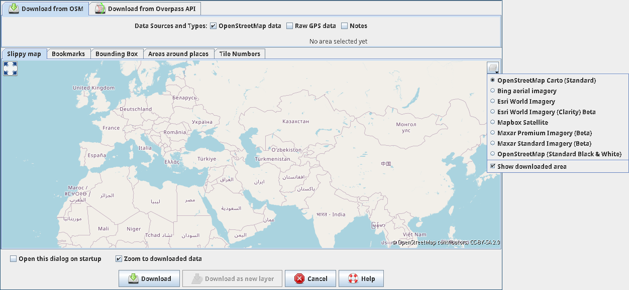
- File >> Download data
- Try to zoom out to see a whole country
- Nothing happens beyond Z14
Alternative:
- If the zoom level is already beyond Z14 you can try to zoom in or out, nothing happens.
What is the expected result?
To see the whole world at Z1, for example.
What happens instead?
Stop at Z14.
Please provide any additional information below. Attach a screenshot if possible.
Relative:URL: ^/trunk
Repository:UUID: 0c6e7542-c601-0410-84e7-c038aed88b3b
Last:Changed Date: 2020-04-30 20:53:59 +0200 (Thu, 30 Apr 2020)
Revision:16387
Build-Date:2020-05-01 01:30:46
URL:https://josm.openstreetmap.de/svn/trunk

Identification: JOSM/1.5 (16387 en) Linux Debian GNU/Linux stable-updates (sid)
Memory Usage: 354 MB / 8008 MB (128 MB allocated, but free)
Java version: 12.0.2+3, Azul Systems, Inc., OpenJDK 64-Bit Server VM
Screen: :0.0 1920x1080, :0.1 3840x2160
Maximum Screen Size: 3840x2160
libcommons-compress-java: libcommons-compress-java:all-1.18-3
libcommons-logging-java: libcommons-logging-java:all-1.2-2
fonts-noto: fonts-noto:all-20200103-3
liboauth-signpost-java: liboauth-signpost-java:all-1.2.1.2-3

Plugins:
+ AddrInterpolation (35405)
+ DirectUpload (35248)
+ FixAddresses (35343)
+ HouseNumberTaggingTool (35248)
+ ImproveOsm (197)
+ InfoMode (35248)
+ Mapillary
+ OpeningHoursEditor (35414)
+ PicLayer (35405)
+ RoadSigns (35424)
+ alignways (35405)
+ apache-commons (35362)
+ apache-http (35092)
+ buildings_tools (35405)
+ conflation (0.6.4)
+ contourmerge (v0.1.6)
+ ejml (35313)
+ ext_tools (35405)
+ fieldpapers (v0.5.0)
+ geochat (35405)
+ geotools (35169)
+ gpsblam (35221)
+ graphview (35405)
+ gson (35313)
+ imagery_offset_db (35405)
+ jaxb (35092)
+ jna (35092)
+ jts (35122)
+ log4j (35092)
+ mapdust (35248)
+ measurement (35405)
+ merge-overlap (35248)
+ opendata (35405)
+ osm-obj-info (56)
+ pbf (35248)
+ photo_geotagging (35405)
+ reltoolbox (35405)
+ reverter (35409)
+ routing (35405)
+ scripting (30796)
+ tageditor (35258)
+ turnlanes (35405)
+ turnlanes-tagging (283)
+ turnrestrictions (35405)
+ undelete (35405)
+ utilsplugin2 (35405)
+ waypoint_search (35248)
+ wikipedia (1.1.3)

Tagging presets:
+ https://josm.openstreetmap.de/josmfile?page=Presets/OneClick&zip=1
+ https://josm.openstreetmap.de/josmfile?page=Presets/NewTags&zip=1
+ https://josm.openstreetmap.de/josmfile?page=Presets/OpenPisteMap&preset&zip=1
+ http://osmtools.de/josm/steps.xml
+ https://josm.openstreetmap.de/josmfile?page=Presets/geoimage.at&preset&zip=1
+ https://josm.openstreetmap.de/josmfile?page=Presets/BicycleJunction&preset&zip=1
+ https://josm.openstreetmap.de/josmfile?page=Presets/Turistautkapcsolat&zip=1
+ https://josm.openstreetmap.de/josmfile?page=Presets/Crafts&zip=1
+ https://josm.openstreetmap.de/josmfile?page=Presets/Maxspeed-zones&zip=1
+ https://josm.openstreetmap.de/josmfile?page=Presets/OpenPisteMap&zip=1
+ https://josm.openstreetmap.de/josmfile?page=Presets/SkiingTrail&zip=1
+ https://josm.openstreetmap.de/josmfile?page=Presets/MountainbikeTrails&zip=1
+ https://josm.openstreetmap.de/josmfile?page=Presets/Communication_Towers&zip=1
+ https://josm.openstreetmap.de/josmfile?page=Presets/Industrial&zip=1
+ https://josm.openstreetmap.de/josmfile?page=Presets/LaneAttributes&zip=1
+ https://josm.openstreetmap.de/josmfile?page=Presets/Leaftype&zip=1
+ https://josm.openstreetmap.de/josmfile?page=Presets/Telecom&zip=1
+ https://raw.githubusercontent.com/yopaseopor/traffic_signs_preset_JOSM/master/HU.zip
+ https://josm.openstreetmap.de/josmfile?page=Presets/Trees&zip=1
+ https://josm.openstreetmap.de/josmfile?page=Presets/Telecom&zip=1

Map paint styles:
- <josm.pref>/<user.name>/SurfaceTracktype.mapcss
+ https://josm.openstreetmap.de/josmfile?page=Styles/Osmc&style&zip=1
- https://josm.openstreetmap.de/josmfile?page=Styles/NumberedWalkingNodeNetworks&style&zip=1
- https://josm.openstreetmap.de/josmfile?page=Styles/Lane_and_Road_Attributes&zip=1
- https://josm.openstreetmap.de/josmfile?page=Styles/Maxspeed&style&zip=1
- https://josm.openstreetmap.de/josmfile?page=Styles/MaxspeedIcons&zip=1
- https://josm.openstreetmap.de/josmfile?page=Styles/Surface&style&zip=1
+ <josm.pref>/<user.name>/BikeNoAccess.mapcss
- https://josm.openstreetmap.de/josmfile?page=Styles/Modified&style&zip=1
- https://josm.openstreetmap.de/josmfile?page=Styles/Lit&style&zip=1
- https://josm.openstreetmap.de/josmfile?page=Styles/Sidewalks&style&zip=1
- https://josm.openstreetmap.de/josmfile?page=Styles/Noname&style&zip=1
- https://josm.openstreetmap.de/josmfile?page=Styles/Fixme&style&zip=1
- https://josm.openstreetmap.de/josmfile?page=Styles/Lane_features&style&zip=1
- https://josm.openstreetmap.de/josmfile?page=Styles/Lane_features_ryg&style&zip=1
- https://josm.openstreetmap.de/josmfile?page=Styles/Cycleways&style&zip=1
- https://josm.openstreetmap.de/josmfile?page=Styles/Landcover&zip=1
- https://drive.google.com/uc?export=download&id=0ByBzOup047W9UWo0SWpoSzZOQVE
- https://josm.openstreetmap.de/josmfile?page=Styles/HU-HighlightHikingTrailSigns&style&zip=1
+ <josm.pref>/<user.name>/heyjoe_tuhu_unprocessed.mapcss
+ http://kolesar.turistautak.hu/osm/styles/measurements.mapcss
+ <josm.pref>/ebdirigo/style.zip

Last errors/warnings:
- W:  No overtaking: Could not get presets icon traffic_signs/HU/HU_C-031.png.png
- W: java.net.SocketTimeoutException: connect timed out
- W: java.net.SocketTimeoutException: connect timed out
- W: java.net.SocketTimeoutException: connect timed out
- W: Already here java.net.SocketTimeoutException: connect timed out
- W: Failed to load Mappaint styles from 'http://kolesar.turistautak.hu/osm/styles/measurements.mapcss'. Exception was: java.net.SocketTimeoutException: connect timed out
- E: java.net.SocketTimeoutException: connect timed out
- W: Initializing map style http://kolesar.turistautak.hu/osm/styles/measurements.mapcss completed in 15.0 s (1 errors, 0 warnings)
- E: Error - <html>Plugin Mapillary requires a plugin which was not found. The missing plugin is:<ul><li>javafx</li></ul></html>
- W: Warning: Failed to scan file 'site-svn.openstreetmap.org-_applications_editors_josm_plugins_opendata_modules.txt' for module information. Skipping.
Attachments (1)
Change History (10)
by , 6 years ago
| Attachment: | 2020-05-15-194728.png added |
|---|
comment:1 by , 6 years ago
comment:2 by , 6 years ago
| Owner: | changed from to |
|---|---|
| Status: | new → needinfo |
comment:3 by , 6 years ago
OSM carto but it is the same for any of them. Z13 is the largest I can reach, and if, somehow, I end up in larger (like Z12 after selecting something based on a search) then I cannot zoom in or out.
comment:4 by , 6 years ago
Does it happen with a new/empty preferences? See Help/CommandLineOptions#Javaoptions.
Do you use default imagery settings?
comment:5 by , 6 years ago
| Resolution: | → invalid |
|---|---|
| Status: | needinfo → closed |
*&%$#@!
It was imagery.tms.min_zoom_lvl. (Took considerable time to pinpoint.) I'm not sure why it limits the slippy, but it does. Something somewhere have set it to 13; I reset it to 2 and it's great again. :-(
comment:6 by , 6 years ago
(As a sidenote, there is imagery.generic.min_zoom_lvl but it seems not to be used for that.)
follow-up: 9 comment:7 by , 6 years ago
Strange, I tested individual min_zoom per layer, and they do not influence slippy map. Think there are some enhancements possible:
- Own/separate settings for jmapviewer
- Visibility of general settings like
imagery.tms.min_zoom_lvlandimagery.generic.min_zoom_lvlin the imagery preferences
comment:8 by , 6 years ago
It is indeed strange since (as far as I remember correctly) I have tried to find all and any zoom related settings and turn the knobs, but eventually I have started *reset* settings *en masse*, and triangulated the culprit to that one, and it was indeed 13 and setting it to 2 indeed fixed it. I'm a bit puzzled myself, too.
But definitely it is confusing if that's used for jmapviewer, and separate config sounds like a good idea. You may reopen the ticket if you feel it have its merits...
comment:9 by , 6 years ago
Replying to skyper:
Strange, I tested individual
min_zoomper layer, and they do not influence slippy map. Think there are some enhancements possible:
- Own/separate settings for jmapviewer
- Visibility of general settings like
imagery.tms.min_zoom_lvlandimagery.generic.min_zoom_lvlin the imagery preferences
In the settings tab under imagery preferences, there is imagery.tms.min_zoom_lvl and imagery.tms.max_zoom_lvl but no imagery.generic.min_zoom_lvl. Maybe it is not used at all.
Below is a check box to add to jmapviewer but is is not obvious what it really does. Is it the whole entry or only settings which are added? Does it change default entries as it seems to be a general setting.
Which layer is activated?