

#16581 closed defect (othersoftware)
WMTS, BGT, not visible anymore on higher zoomlevel. 17--->
| Reported by: | Allroads | Owned by: | team |
|---|---|---|---|
| Priority: | normal | Milestone: | |
| Component: | Core imagery | Version: | tested |
| Keywords: | WMTS PDOK zoom netherlands | Cc: | wiktorn |
Description (last modified by )
We use the BGT omtrekgericht (outline lines) layer url in the page as a transparant over a aerial imagery, Luchtfoto 2017 or actual, Netherlands.
We use it to line out the ways, highway=*, on the middle of the road.
Therefor, the more we zoom in the accurate we can place the way/node!
In JOSM it was possible to zoom in further then the last two weeks. We saw the outline lines even with only the width of the road on the JOSM map/edit screen.
Why did this changed?
I noticed it, but also others on the forum complained about is. Difficult to place the way well.
Forum discussion
I asked if the layer changed on the forum of the Dutch Government.
Discussion on PDOK
I openend the url wmts also in QGIS and the layer stopped, where the PDOK viewer stopped also.
Is there something changed in JOSM so that we can not see the imagery layer beyond the actual PDOK zoomlevel. 16.
PDOK talk about expand images on lowest level.
Is this done in the past?
Is there a solution to get it back, more zoomlevels?
For us it is important to get it back, to draw in the ways as correct as possible.
The data is measured in by the Municipalities, very correct.
We want to zoom in more then this level.
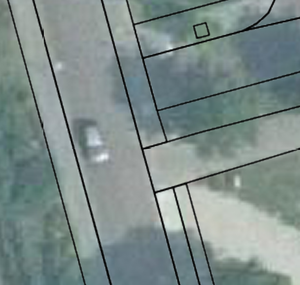
Image part screenshot JOSM

Attachments (2)
Change History (14)
by , 8 years ago
| Attachment: | car1JOSM.png added |
|---|
comment:1 by , 8 years ago
| Description: | modified (diff) |
|---|
comment:2 by , 8 years ago
comment:3 by , 8 years ago
| Keywords: | netherlands added |
|---|
by , 8 years ago
| Attachment: | QGIS1tot397.png added |
|---|
comment:4 by , 8 years ago
QGIS is working as expected. The last layer shown was on 1:397

Strange, this behaviour, we could zoom in much deeper in JOSM and still see the outlines. And we appreciated that.
comment:5 by , 8 years ago
| Description: | modified (diff) |
|---|
comment:6 by , 8 years ago
| Cc: | added |
|---|
comment:8 by , 8 years ago
This morning I got a message from PDOK forum, after giving a x y place where it happend.
Translation:
In some places (apparently not everywhere, see my first message(in PDOK)) the cache gives back empty pictures at zoom level 16. We are going to look at it and solve it
Waiting for the results.
comment:10 by , 8 years ago
PDOK deleted the cache on the server.
And now all looks fine again in JOSM. Tested on the location as above imagery.
Apparently, there where empty imagery on zoom 16 in cache, these showing in JOSM and expanded empty imagery on zoom 17 18 19 on JOSM zoom. Did not show some.
comment:11 by , 8 years ago
| Resolution: | → fixed |
|---|---|
| Status: | new → closed |
comment:12 by , 8 years ago
| Resolution: | fixed → othersoftware |
|---|
Nothing has changed in the past two weeks. Last change was 4 months ago and it actually increased the max zoom level.
Likely this has nothing to do with JOSM. I don't understand the results you get with QGIS? Is it working as expected with it?