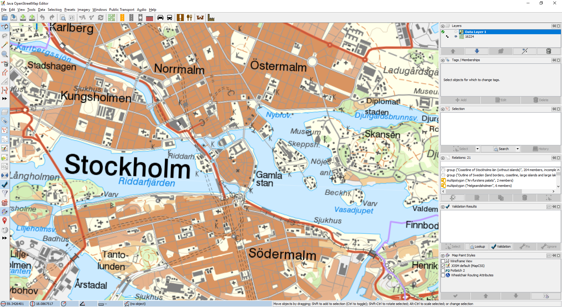
#16224 closed defect (fixed)
Trouble with EPSG:3006 WMTS service
| Reported by: | nkamapper | Owned by: | team |
|---|---|---|---|
| Priority: | normal | Milestone: | 18.04 |
| Component: | Core imagery | Version: | |
| Keywords: | template_report sweden projection | Cc: | wiktorn |
Description
I am having trouble accessing the following WMTS service:
https://api.lantmateriet.se/open/topowebb-ccby/v1/wmts/token/9b342b7d9f12d4ddb92277be9869d860/?request=getcapabilities&service=wmts
After I enter it as a new WMTS layer in the imagery window, JOSM delivers the following error message:
javax.net.ssl.SSLHanshakeException: Remote host closed connection during handshake.
On a different MacBook, where the imagery had already been entered under an earlier JOSM version, no tiles are displayed (never worked).
The imagery works in QGIS, but with a "problem" message
The imagery is listed as EPSG:3.6:3006. There have been reported difficulties in interpreting this service elsewhere but solutions have been found, examples:
https://github.com/BruTile/BruTile/issues/44
https://gis.stackexchange.com/questions/120325/what-is-proper-succession-of-coordinates-while-specifying-topleftcorner-in-tilem
The imagery in question is the only open and official topographic map for Sweden, recently under CC0 license and the best available background map for the country, so it would be great if it would somehow work in JOSM.
Here is the technical information provided (in Swedish, sorry):
https://opendata.lantmateriet.se/api/OpenDataWMTS/v1/TopografiskaWebbkartanOversiktlig_101.pdf
Please provide any additional information below. Attach a screenshot if possible.
URL:https://josm.openstreetmap.de/svn/trunk
Repository:UUID: 0c6e7542-c601-0410-84e7-c038aed88b3b
Last:Changed Date: 2018-03-26 22:16:39 +0200 (Mon, 26 Mar 2018)
Build-Date:2018-03-26 20:45:23
Revision:13576
Redirecting:to URL 'https://josm.openstreetmap.de/svn/trunk':
Relative:URL: ^/trunk

Identification: JOSM/1.5 (13576 nb) Mac OS X 10.13.4
OS Build number: Mac OS X 10.13.4 (17E199)
Memory Usage: 1473 MB / 3641 MB (1025 MB allocated, but free)
Java version: 1.8.0_161-b12, Oracle Corporation, Java HotSpot(TM) 64-Bit Server VM
Screen: Display 722476178 3008x1692
Maximum Screen Size: 3008x1692
VM arguments: [-Djava.security.policy=file:<java.home>/lib/security/javaws.policy, -DtrustProxy=true, -Djnlpx.home=<java.home>/bin, -Djava.security.manager, -Djnlpx.origFilenameArg=${HOME}/Library/Application Support/Oracle/Java/Deployment/cache/6.0/56/1ee8cfb8-1cbde886, -Djnlpx.remove=false, -Dsun.awt.warmup=true, -Djava.util.Arrays.useLegacyMergeSort=true, -Dmacosx.jnlpx.dock.name=JOSM, -Dmacosx.jnlpx.dock.icon=${HOME}/Library/Application Support/Oracle/Java/Deployment/cache/6.0/16/47ee53d0-54f0b665.icns, -Djnlp.application.href=https://josm.openstreetmap.de/download/josm.jnlp , -Djnlpx.jvm="<java.home>/bin/java"]

Plugins:
+ apache-commons (34109)
+ changeset-viewer (14)
+ conflation (0.5.7)
+ ejml (34126)
+ geojson (80)
+ geotools (34125)
+ imagery-xml-bounds (34109)
+ jts (34038)
+ opendata (34132)
+ reverter (34109)
+ todo (30303)
+ utilsplugin2 (34109)

Tagging presets:
+ https://josm.openstreetmap.de/josmfile?page=Presets/LaneAttributes&zip=1
+ https://raw.githubusercontent.com/OpenNauticalChart/josm/master/INT-1-preset.xml

Map paint styles:
+ https://josm.openstreetmap.de/josmfile?page=Styles/Lane_and_Road_Attributes&zip=1
- https://raw.githubusercontent.com/OpenSeaMap/josm/master/CEVNI_MapCSS.mapcss
- https://raw.githubusercontent.com/OpenSeaMap/josm/master/INT1_Seamark.mapcss

Last errors/warnings:
- W: No configuration settings found.  Using hardcoded default values for all pools.
- W: javax.net.ssl.SSLHandshakeException: Remote host closed connection during handshake. Årsak: java.io.EOFException: SSL peer shut down incorrectly
Attachments (1)
Change History (15)
comment:1 by , 8 years ago
comment:2 by , 8 years ago
| Keywords: | sweden projection added |
|---|
comment:3 by , 8 years ago
| Milestone: | → 18.04 |
|---|
by , 8 years ago
follow-up: 11 comment:7 by , 8 years ago
Thank you for the rapid response. Will include the map in Maps/Sweden when the fix is live in the stable version.
follow-up: 10 comment:8 by , 8 years ago
Would it be possible to define the relevant map layer in Maps to get direct access to that WMTS layer without choosing it every time in the menu?
Like WMS without wms_endpoint.
comment:9 by , 8 years ago
| Cc: | added |
|---|
follow-up: 12 comment:10 by , 8 years ago
Replying to nkamapper:
Would it be possible to define the relevant map layer in Maps to get direct access to that WMTS layer without choosing it every time in the menu?
Like WMS without wms_endpoint.
@wiktorn: is this what you're working on?
comment:11 by , 8 years ago
Replying to nkamapper:
Thank you for the rapid response. Will include the map in Maps/Sweden when the fix is live in the stable version.
You can already add it, no need to wait. The stable is expected very soon anyway.
comment:12 by , 8 years ago
Replying to Don-vip:
Replying to nkamapper:
Would it be possible to define the relevant map layer in Maps to get direct access to that WMTS layer without choosing it every time in the menu?
Like WMS without wms_endpoint.
@wiktorn: is this what you're working on?
Correct, that's what I'm working on. I hope to get this finished in May.


Possibly related to #11701