

Opened 12 years ago
Closed 12 years ago
#10963 closed enhancement (fixed)
Improve default map style for place=village/town/city
| Reported by: | Don-vip | Owned by: | team |
|---|---|---|---|
| Priority: | normal | Milestone: | 15.01 |
| Component: | Internal mappaint style | Version: | |
| Keywords: | place village town city | Cc: | Klumbumbus |
Description (last modified by )
We could improve our handling of place=village/town/city:
- have a distinct icon for each one of these 3 values (by its size and/or color for example)
- maybe change default zoom level at which they appear. Cities first, then towns, then villages?
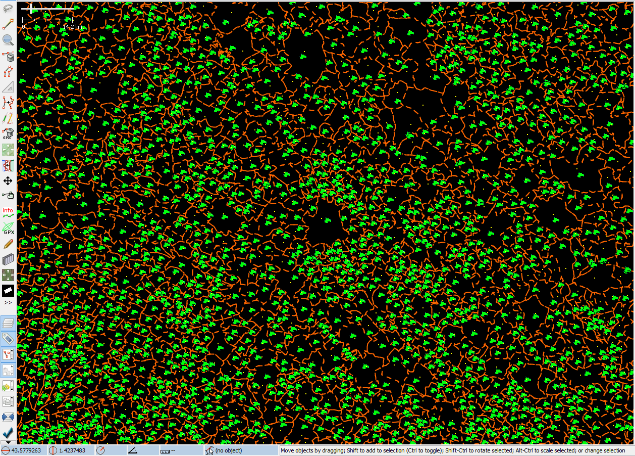
I'd like to be able to actually see cities and towns at high zoom level on attached file:

Revision: 7950
Is-Local-Build: true
Build-Date: 2015-01-11 18:57:01

Identification: JOSM/1.5 (7950 SVN en) Windows 8.1 64-Bit
Memory Usage: 1627 MB / 2731 MB (728 MB allocated, but free)
Java version: 1.8.0_25, Oracle Corporation, Java HotSpot(TM) 64-Bit Server VM
VM arguments: [-Dfile.encoding=UTF-8]
Program arguments: [--debug]
Dataset consistency test: No problems found
Attachments (3)
Change History (19)
by , 12 years ago
| Attachment: | places.png added |
|---|
comment:1 by , 12 years ago
| Description: | modified (diff) |
|---|
comment:2 by , 12 years ago
by , 12 years ago
comment:3 by , 12 years ago

I can imagine different colors for every place type. Currently we use only two. (Hamlet, Farm, Isolated Dwelling and Neighbouhood should share a color to make it less colorful)
For hiding or displaying special place types maybe filters are the better choice than zoom levels.
by , 12 years ago

comment:5 by , 12 years ago
Also with object-z-index we could make sure, that higher order place icons are always drawn on top of lower order place icons (if they are near to each other on low zoom). Currently I think the order depends on the id.
comment:7 by , 12 years ago
Still different colours and a priority by order would be nice enhancements.
comment:8 by , 12 years ago
| Milestone: | → 15.01 |
|---|
comment:10 by , 12 years ago
| Resolution: | → fixed |
|---|---|
| Status: | new → closed |
comment:11 by , 12 years ago
While I like the different colours in the preset and on low zoom, they fail on high zoom and in representing a nice order. In my understanding we have city - town - village - hamlet - isolated_dwelling in one line while suburb - neighborhood and farm are always parts of one of the first.
Right now it is not possible to distinguish between a wrongly tagged farm which should be an isolated_dwelling or the opposite. Same is true for hamlet <-> neighborhood.
Sadly, above examples are often true (values mixed up) and I still have to select the node to check it.
Maybe it is possible to change the order of colour a little bit and use some lighter green and white/grey as additional colours. Thanks
comment:12 by , 12 years ago
| Resolution: | fixed |
|---|---|
| Status: | closed → reopened |
comment:16 by , 12 years ago
| Resolution: | → fixed |
|---|---|
| Status: | reopened → closed |
Replying to Klumbumbus:
Should be ok now. Can you please check tomorrow skyper?
Thanks, much better now.
Please, also look at
hamlet,suburb,neighbourhood,isolated_dwellingand maybe evenfarm.The real problem is the diversification in density across the globe but also within small areas. So far, I did not find any style which is managing this job acceptably, and Mapnik-carto is failing completely.