

| Version 7 (modified by , 17 years ago) ( diff ) |
|---|
Introduction to JOSM
Terminology
I'll refer to "roads" below, but the same applies to any "way", eg footpaths, bridleways, railways, rivers etc, basically any line you want represented in OSM.
A "node" represents the start and end of a segment, and should be wherever there is a significant change in direction, or a junction. "Segments" are then drawn between each node, with curves being made up of a series of segments. Lastly a road will be represented by a "way", which is a group of segments which are collected together. In general in urban areas it would be usual for most roads to be formed into only one way, but when you get out of towns the roads become longer and may be represented by a number of ways next to each other.
Prior to actually editing
Before you start to add or amend OpenStreetMap data, you will somehow need to know where your roads are going to be!
The easiest case to start with is where you have your own GPX track of a route saved on your own computer. Use menu option Files > Open to load the GPX file into JOSM. You will then see in the main map view window a series of dots representing your GPX track.
An alternative is to download existing GPX points from the OSM server. In order to start this process you will need to know the latitude and longitude coordinates of the relevant area. The easiest way to do this is to visit the map and to zoom in to the area you are interested in, then to move the mouse over the View tab, and copy the resulting link. You will need to have zoomed in to a fairly small area, in residential areas where there is a lot of existing OSM activity you will need to be at a zoom level of 12, other less dense areas will probably be bale to be downloaded at zoom level 14. Once you have copied the OSM link ( which will look something like http://www.openstreetmap.org/index.html?lat=50.687181128986&lon=-1.0795289310465817&zoom=14) you can then paste this into the "URL from open streetmap.org box on the JOSM download option.
Editing in JOSM
The first step of actual editing is to add a node to the OSM data where there will be a junction or a significant change in direction. Make sure the node button (4th button in the left menu bar) looks like a little square and when you hover the mouse over it a tip comes up saying "add a node to the map". If the button looks like a series of three squares with lines between them, and the tip says "add a node into an existing segment", then click the tiny black triangle on the node button and select the single square. To add a node, highlight the node button, either by clicking the 4th button in the left menu bar, or by hitting the "n" key on the keyboard (the 4th button should then be highlighted). Move the mouse cursor over your GPS track, and left click it wherever you want a node to be. A white dot (a selected node) should appear, and as you create subsequent nodes the earlier nodes will be shown as red dots.
Once you have a series of nodes, the next thing you'll need to do is to draw segments between them. Click the button below the node button, or hit "g" on the keyboard. Move the mouse cursor over a node, left click and hold down the left mouse button whilst dragging the cursor to an adjacent node, the release the left mouse button. A segment, represented by a line between the nodes should now exist. These will initially be shown in white since as you draw them they are deemed to be selected. When you have drawn all the segments in a way, you need to highlight all of them. If you have just been creating them they all will be highlighted anyway, but if you need to add old segments (shown as green lines between nodes) then click the select menu button and holding down the shift key, click on all the segments you want to form the way. Once all the segments are selected click the way button, the sixth button down, or hit "w" on the keyboard, and a dialog box should appear saying "create a way out of x segments", click yes and you have created a way, initially it will be shown in white, but if you click the select button, or click "s" on keyboard, and then left click away from the way, you will de-select it and it should be shown in blue.
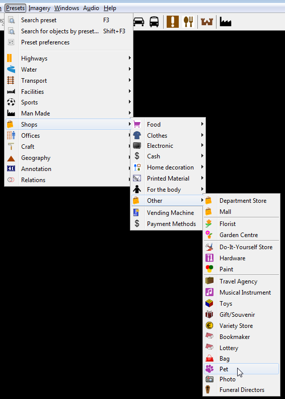
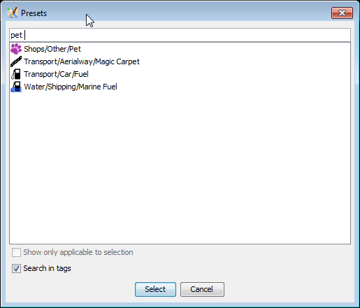
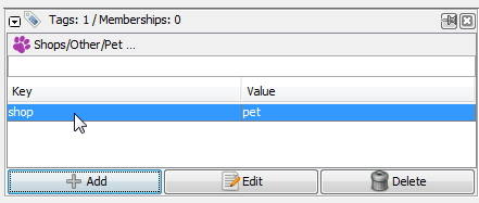
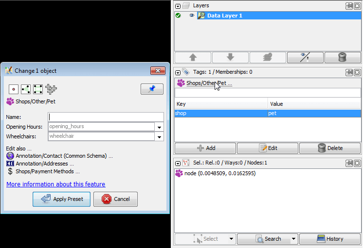
Ways on their own are not much use unless they are tagged to say what they represent. Map Features shows all the current key value pairs which could be used on a way. Ensure the "properties" window is open on the Right hand side of JOSM, the 10th button on the left ( a hand pointing to a box) should be highlighted, if not click the button on hit "Alt+P". On the Right hand side of JOSM there should be a properties window, it will have a "plus" sign with add next to it, then edit, then delete. Ensure your new way is highlighted, then click the "add" button, a dialog box will appear and you will be asked to select a key and a value. Type in the key/value pair which represents the way you are creating, eg for the key type "highway" without the quotes, and for value type "secondary" again without the quotes. then click OK. You have now tagged your way.
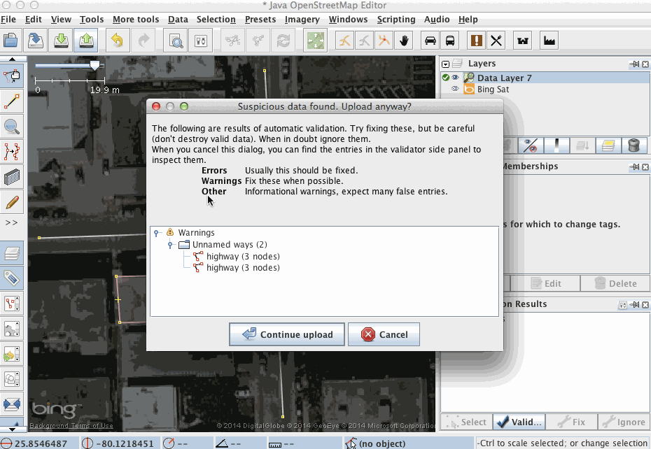
If you are happy with all that you have done then you need to upload this to OSM server.
Conventions
A couple of other points about creating segments and ways.
1) Dual carriage ways should be drawn as two separate parallel sets of segments, with each carriage way being a different way.
2) If a street is one way (including the individual carriageways of a dual carriageway) the segments should be drawn in the direction of travel.
3) If a street is not one way, then to make the rendering in Osmarender look correct:
all segments which will comprise a way should be drawn in the same direction.
street names are rendered in the direction of travel, so it is helpful if segments are drawn left to right, then the street names appear the correct way up
4) All segments in a way should be in order, this will be done automatically by JOSM if all the segments are turned into a way in one go, but you can add new segments to an existing way, and this sometimes causes the order to get jumbled up. Ways can be re-ordered using Edit > Reorder segments.
5) The key / value tagging is case sensitive, all keys should be entered in lower case
Back to Main Help
Attachments (9)
-
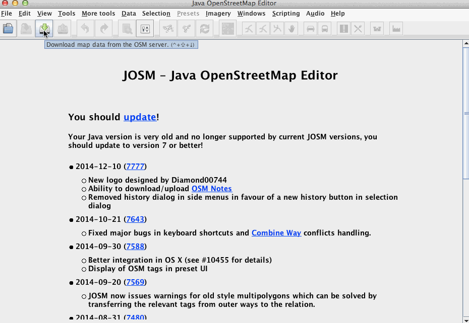
download-data.gif
(654.3 KB
) - added by 8 years ago.
https://github.com/mapbox/mapping/wiki/Getting-started https://github.com/mapbox/mapping/issues/162
-
poi-restourant.gif
(403.8 KB
) - added by 8 years ago.
https://github.com/mapbox/mapping/wiki/Mapping%20Common%20Features#simple-point-of-interest https://github.com/mapbox/mapping/issues/162
- poi-fountain.gif (142.8 KB ) - added by 8 years ago.
-
enable-imagery.gif
(2.3 MB
) - added by 8 years ago.
https://github.com/mapbox/mapping/wiki/Mapping-with-JOSM#using-imagery https://github.com/mapbox/mapping/issues/162
-
uploading data.gif
(668.8 KB
) - added by 8 years ago.
https://github.com/mapbox/mapping/wiki/Mapping-with-JOSM#uploading-to-openstreetmap https://github.com/mapbox/mapping/issues/162
- presets-from-main-menu.png (53.1 KB ) - added by 8 years ago.
- presets-f3-search.png (13.2 KB ) - added by 8 years ago.
- presets-in-tag-toggle.png (10.5 KB ) - added by 8 years ago.
- single-preset-shown-in-context-of-tagsmemberships-single-object.png (17.9 KB ) - added by 8 years ago.