

| Version 66 (modified by , 7 years ago) ( diff ) |
|---|
Languages:
- dansk
- Deutsch
- English
- español
- français
- 日本語
- Nederlands
- русский
- svenska
- українська
File > Download from OSM
 Keyboard shortcut:
 Ctrl+Shift+↓
Download data from server.
Table of Content
Type of Data
Different types of data can be downloaded:
The type is chosen with the checkboxes at the top of the window. (It is possible to download all three types at once).
Area to download
The dialog has multiple tabs. The exact configuration of tabs may be dependent on plugins you have installed, but you will generally at least have the following five.
When switching between tabs, the area shown in each tab will be the same. So if you select a bookmark for example and switch to the slippy map tab, the area of that bookmark is shown.
Note: When the download dialog is called up with data already loaded, all fields are set to the currently visible bounding box. Thus a common use scenario is to first load your GPS track from a GPX file, then zoom the view so that the portion you wish to work on is fully visible, and then call up the download dialog which will reflect the visible area.
Slippy map
 The Slippy map provides a movable map like on the OSM front page with which you can interactively select the area to download. Only differences are that
 Shift+Click to zoom is not available, move the map the JOSM way by press and hold the right mouse button and select an area by press and hold the left mouse button.
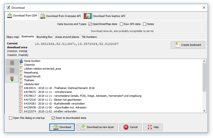
Bookmarks
In the Bookmarks tab you can select from your predefined bookmarks, or create a new bookmark from the current bounding box (bbox) or the area defined in another tab respectively.
There are special bookmarks, which can't be modified directly:
- The Home location bookmark represents the home location, which you have set in your osm profile on osm.org.
- With the
 button on the left you can download the bboxes of you last 15 changesets, which are added as bookmarks then.

Double click on a bookmark to directly download the related bbox or single click on a bookmark, switch to the Slippy map tab and adjust the bbox before downloading.
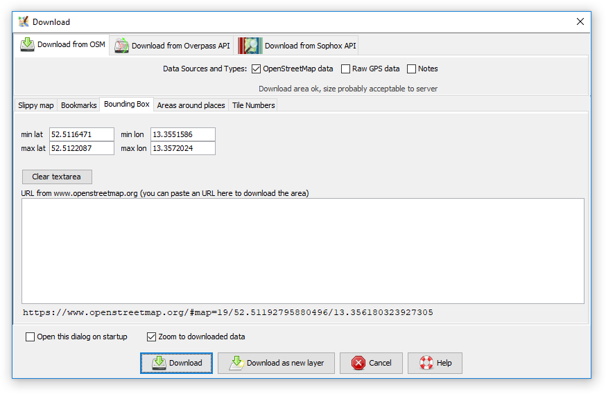
Bounding Box
In the Bounding Box tab you can set the latitude/longitude bounds of the data to be downloaded, and also paste an URL from either www.openstreetmap.org.
- To paste from the map on the OpenStreetMap site, zoom into the area you are interested in, then either move the mouse over the "view" tab, and copy the resulting URL, or copy the permalink given in the bottom right corner. Then go to JOSM, and paste this URL into the "URL from www.openstreetmap.org" box. (In Windows to paste into the box, left click on the box, and then do CTRL+v).
- To paste from www.openstreetmap.org zoom to the area you are interested in, and then copy the permalink location from the bottom right of the screen, and paste as described above.
Instead of pasting the URL in the text box, you can press [CTRL]+[V] on any other tab to parse the bounds from the clipboard URL.
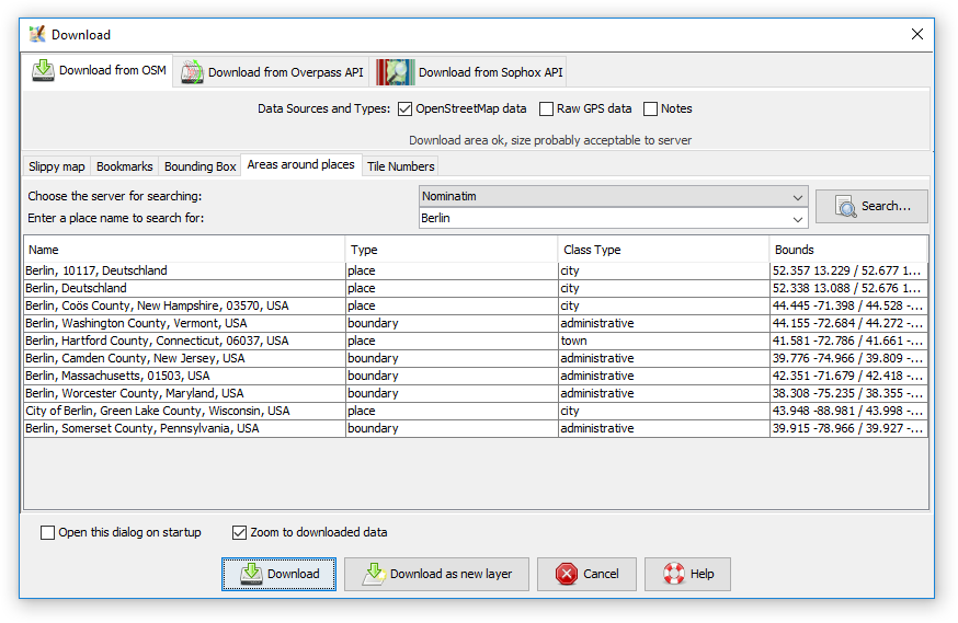
Area around places
On the Area around places tab you can search for specific places, street names, etc, in the OSM database. Currently, there is only one server for the search available: Nominatim. After you have clicked on a search result you can switch back to the Slippy map tab (which has zoomed to the area of the search result) and adjust the bounding box.
Tile Numbers
In the Tile Numbers tab you can enter a number of tiles and a zoom level to download data of those tiles. Alternatively, you enter a Tile address. This might look a little awkward, especially when reading how to compute the tile numbers. But sometimes it comes in handy. If you want to easily determine the tile numbers with the mouse, see this help center question.
Area too large
There might be a red warning at the bottom left displayed if the selected area is too large for the server and will likely be answered with an error message.
You can download bigger areas using several smaller ones.
Layer control
You can control whether the data is loaded into the current or in a new layer with the checkbox in the bottom left corner of the window:
- if Download as new layer is selected, the data is loaded in a new layer
- if Download as new layer is not selected, the data is loaded in the current data layer
If there isn't any data layer yet, a new data layer is always created.
Display
Clicking on the ![]() button on the upper right gives you the option to change the displayed map (rendering machine) for this window. The available maps are based on your Imagery preferences.
button on the upper right gives you the option to change the displayed map (rendering machine) for this window. The available maps are based on your Imagery preferences.
An example of the displayed selection:
- OpenStreetMap (Mapnik)
- Cyclemap
- Bing Aerial Maps
- MapQuest Open Aerial
Mirror Download Plugin
- The XAPI query syntax is explained in the OSM wiki.
See also
 Download object
 Download parent ways and relations
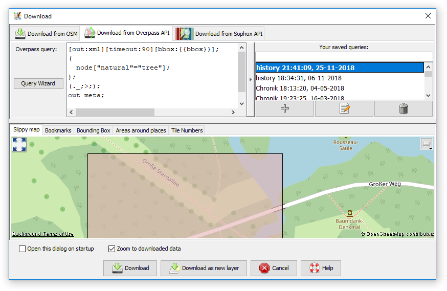
 Download from Overpass API
 Download in current view
 Open Location


Attachments (9)
- Wizard.png (20.3 KB ) - added by 7 years ago.
- Favorite.png (8.5 KB ) - added by 7 years ago.
- AreaAroundPlaces.png (42.4 KB ) - added by 5 years ago.
- BBox.png (29.9 KB ) - added by 5 years ago.
- Bookmarks.png (45.3 KB ) - added by 5 years ago.
- Overpass.png (63.2 KB ) - added by 5 years ago.
- SlippyMap.png (133.3 KB ) - added by 5 years ago.
- Sophox.png (62.6 KB ) - added by 5 years ago.
- TileNumbers.png (53.7 KB ) - added by 5 years ago.
Download all attachments as: .zip